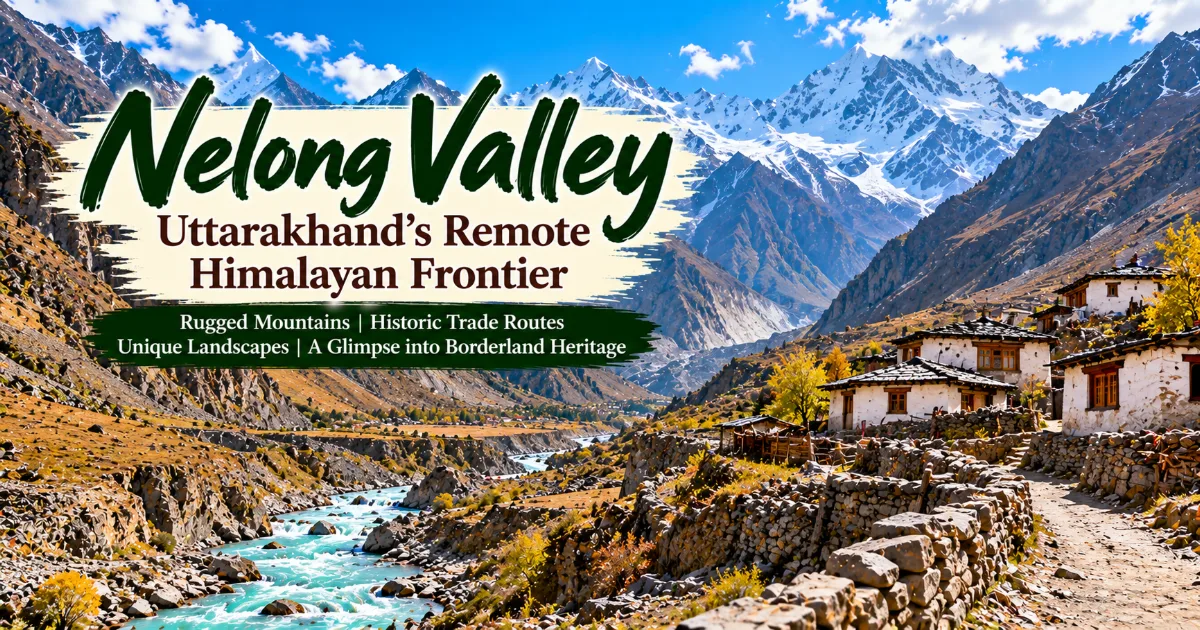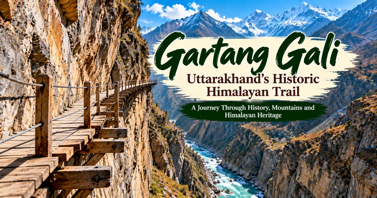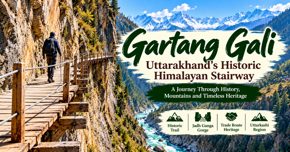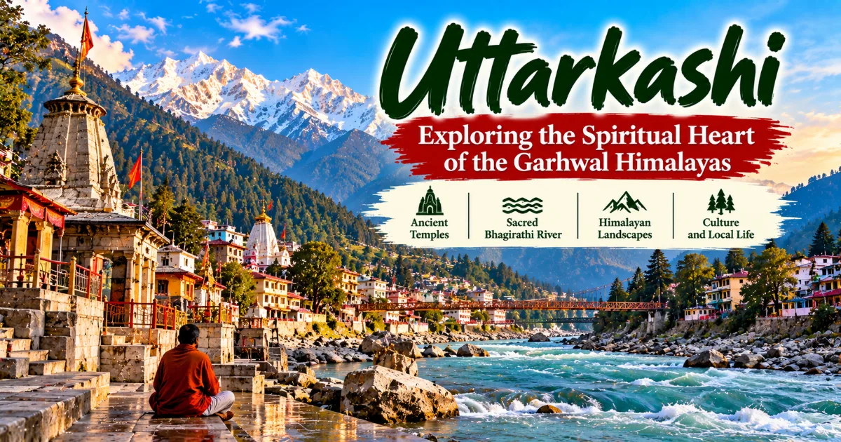
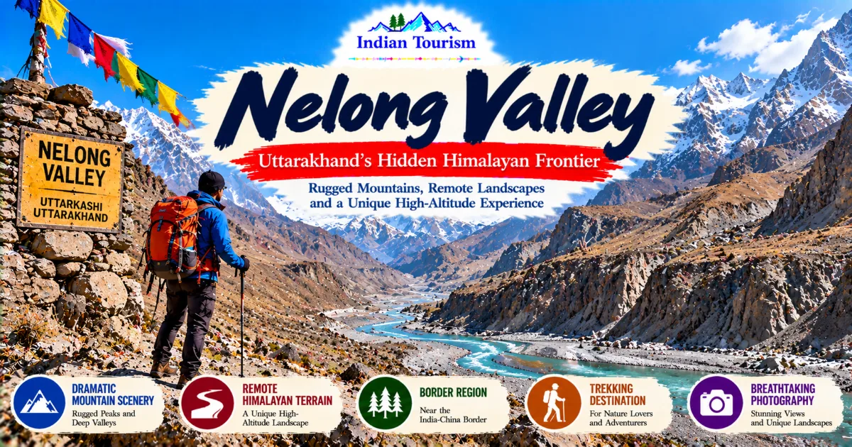
Nelong Valley is one of Uttarakhand’s most remote and striking high-altitude landscapes, located in the Uttarkashi district near the India-China border.
Known for its barren mountains, dramatic rock formations, deep gorges, and cold desert scenery, the valley offers a very different experience from Uttarakhand’s green forests and alpine meadows.
Access is restricted and subject to official permissions, making advance planning essential for anyone hoping to explore this extraordinary Himalayan frontier.
Discovering Nelong Valley
Uttarakhand is widely known for its snow-covered Himalayan peaks, sacred rivers, forested valleys, alpine meadows, and ancient pilgrimage routes. Yet the state also contains landscapes that appear almost otherworldly, where vegetation becomes sparse, mountains rise in rugged formations, and the terrain resembles a high-altitude desert. Nelong Valley is one of the most distinctive examples of this dramatic environment.
Located in Uttarkashi district, Nelong Valley lies within the broader Gangotri region of the Garhwal Himalayas. Its landscape is shaped by extreme mountain conditions, limited vegetation, rocky slopes, and the powerful geological forces that have formed the high Himalayas over millions of years. Rather than presenting the familiar image of green Himalayan hillsides, Nelong reveals an austere landscape of grey rock, brown ridges, deep valleys, and distant snow-covered summits.
The valley's remoteness is an important part of its character. It is not a conventional tourist destination where visitors can arrive freely, choose a roadside viewpoint, and explore without restrictions. Its proximity to the international border and its strategic importance mean that access is controlled. Visitors must confirm the current rules, eligibility requirements, and permission process with the relevant authorities before making travel arrangements.
Continue Reading
For travellers interested in geography, Himalayan history, mountain photography, and remote landscapes, Nelong Valley offers a compelling subject. Its barren terrain illustrates how dramatically the Himalayan environment can change with altitude, exposure, rainfall, and local geography. The valley also provides an opportunity to understand the relationship between mountain landscapes, historic routes, border management, and communities that have lived in these high-altitude regions.
The most rewarding way to approach Nelong Valley is with curiosity and respect. Its value lies not simply in its unusual appearance but also in the geographical, cultural, and historical context that makes this remote part of Uttarakhand different from the state's more familiar destinations.
Where Is Nelong Valley Located?
Nelong Valley is situated in Uttarkashi district in northern Uttarakhand, close to the India-China border. The valley lies within the wider Gangotri region, an area associated with high Himalayan terrain, the Bhagirathi river system, remote mountain routes, and the dramatic landscapes surrounding Gangotri National Park.
The surrounding region contains steep rocky mountains, deep gorges, exposed slopes, and sections where vegetation is limited by the harsh environment. The terrain differs from the forested valleys and green hill stations that many travellers associate with Uttarakhand.
The broader area is also geographically significant because it lies within a sensitive border region. Travel conditions and access arrangements are therefore different from those of ordinary tourist destinations. Permission requirements may depend on citizenship, the specific route, prevailing security arrangements, and official instructions in force at the time of travel.
Visitors should not assume that a permit obtained for one part of Uttarkashi district automatically allows entry into Nelong Valley. They should also avoid relying on outdated travel blogs or old social media posts for information about access.
Before planning a trip, contact the appropriate local administration or authorised tourism officials to establish whether visits are permitted, which documents are required, what restrictions apply, and whether any parts of the route are temporarily closed.
This step is essential because the valley's remoteness and strategic location make independent travel arrangements more complicated than those required for many other Himalayan destinations.
Why Nelong Valley Is Different from Other Himalayan Destinations
A High-Altitude Cold Desert Landscape
One of Nelong Valley's defining features is its dry, rugged appearance. Many parts of Uttarakhand receive substantial rainfall or support dense forests, but the terrain in this high-altitude border region can appear markedly different.
The landscape contains exposed rock, steep slopes, sparse vegetation, and broad areas where the dominant colours are grey, brown, and muted gold. In some places, the mountains rise sharply above narrow valleys, creating a dramatic sense of scale.
The cold desert character is influenced by local topography and climatic conditions. Mountain barriers affect the movement of weather systems, while altitude and exposure influence temperature and vegetation. These factors help create a landscape that looks very different from the moist forests found at lower elevations.
For visitors, this contrast is one of the valley's greatest attractions. Nelong demonstrates that the Himalayas are not a single uniform environment. They contain many ecological zones, each shaped by its own combination of climate, geology, elevation, and water availability.
Dramatic Gorges and Rocky Mountains
The valley's rugged terrain creates striking natural formations. Deep cuts in the landscape, steep rock faces, and narrow passages reveal the power of erosion and geological change in a mountain region.
Over long periods, flowing water, freeze-thaw cycles, landslides, and other natural processes have contributed to the formation of the Himalayan landscape. Exposed rock also allows visitors to appreciate the scale and complexity of the terrain more directly than in heavily forested areas.
Photographers often find such environments visually compelling because the shapes and textures of the mountains create strong contrasts. A narrow ridge may appear against a distant snow-covered peak, while shadows can emphasise the depth of a gorge.
However, the same terrain that creates spectacular scenery can also present hazards. Rockfall, unstable slopes, sudden weather changes, and difficult road conditions should never be overlooked. Visitors must follow official instructions and avoid leaving authorised routes in search of a better photograph.
A Remote Borderland
Nelong Valley's proximity to the India-China border gives it a significance that extends beyond natural beauty. The region forms part of a sensitive frontier landscape where geography, security, and transport infrastructure intersect.
Border regions often have histories shaped by trade, migration, political change, and the movement of people across mountain passes. Nelong's location places it within this wider Himalayan story.
Today, security arrangements influence how visitors can approach the valley. Restricted access is not merely a tourism formality. It reflects the strategic importance of the region and the need to protect sensitive locations and infrastructure.
Travellers should respect checkpoints, photography restrictions, identification requirements, and directions from authorised personnel. They should never attempt to enter restricted areas without permission or use unofficial routes to bypass controls.
Understanding these realities makes it easier to appreciate Nelong Valley as both a natural landscape and a place with contemporary strategic importance.
The Historical Importance of Nelong Valley
Ancient Himalayan Connections
The high Himalayas have long contained routes connecting valleys, settlements, and regions on either side of major mountain ranges. Long before modern highways and administrative boundaries, people in many Himalayan areas relied on footpaths, seasonal routes, and mountain passes for movement and exchange.
The wider Nelong region is associated with historical routes that connected parts of present-day Uttarakhand with the Tibetan plateau. Such routes formed part of a broader network through which traders, pastoral communities, and travellers moved goods and maintained social relationships.
Movement through high mountain terrain was never easy. Travellers had to understand seasonal weather, river crossings, animal movement, and the availability of shelter and supplies. The ability to navigate the mountains depended heavily on local knowledge and experience.
Historical Himalayan routes should not be imagined as simple roads through empty wilderness. They were part of lived landscapes that included settlements, grazing areas, cultural practices, and relationships between communities.
Nelong's rugged setting helps visitors appreciate why mountain routes required considerable skill and why access to particular passes could be economically and strategically important.
Trade and Regional Exchange
Historically, parts of the wider Himalayan border region participated in trade between communities on different sides of the mountains. Depending on the route and period, exchanges could include wool, salt, livestock products, grain, and other goods suited to local economic needs.
Trade across high-altitude regions depended on geography and seasonal accessibility. Routes could become difficult or unusable during severe winter conditions, while the availability of animals, supplies, and local guides influenced the movement of goods.
These networks were not simply commercial systems. Trade also supported cultural interaction and the exchange of knowledge, customs, and practices. Communities living in mountain regions often developed relationships that reflected shared environmental challenges and long histories of contact.
The modern political boundaries of the region differ from the historical arrangements under which some of these routes operated. Changes in border management and political relations have affected movement across the Himalayas.
When exploring Nelong Valley's history, it is important to distinguish broad regional patterns from claims about specific events or routes. Detailed historical accounts should be checked against reliable historical and administrative records rather than inferred solely from the landscape.
Changing Border Conditions
The twentieth century brought major political and administrative changes to the Himalayan borderlands. The establishment and strengthening of modern international borders transformed how people, goods, and travellers could move through these regions.
Border controls, security concerns, and changing political relationships have affected traditional routes across parts of the Himalayas. Communities that once participated in wider networks of movement have had to adapt to new administrative realities.
Nelong Valley's present-day restrictions reflect this wider transformation. Visitors encounter a landscape where historical connections coexist with modern security requirements.
Understanding this context helps explain why a remote valley can be geographically fascinating but not freely accessible. The same mountain routes that once supported movement and exchange may now fall within controlled areas where travel is subject to official approval.
The Landscape and Natural Environment
Rocky Slopes and Exposed Terrain
The most immediate impression of Nelong Valley is its rugged terrain. Rocky slopes rise above the valley, and sections of the landscape appear sparsely vegetated. This visual character reflects the demanding environmental conditions of the high Himalayas.
Temperature fluctuations, wind exposure, limited soil development, and the availability of water all influence vegetation. Plants that survive in such conditions often need to tolerate short growing seasons and considerable temperature variation.
The exposed geology also offers a reminder that the Himalayas are a relatively young mountain system in geological terms, still being shaped by tectonic forces and erosion. Landslides and rockfall are natural processes in steep terrain, although human activity and weather conditions can influence local risks.
Visitors should observe the landscape from authorised viewpoints and roads. Climbing unstable slopes or approaching exposed edges can be dangerous, particularly when wind, ice, or loose rock affects footing.
Sparse Vegetation and Mountain Ecology
The vegetation around Nelong Valley is adapted to the harsh conditions of the high-altitude environment. Compared with lower Himalayan forests, some areas have much less plant cover, especially on exposed slopes and rocky surfaces.
Where vegetation occurs, it contributes to soil stability, provides habitat, and supports ecological processes that may be difficult to notice at first glance. Even sparse plant communities can be important in environments where growing conditions are demanding.
The ecological value of a cold desert landscape should not be judged by how green it appears. Environments with limited vegetation may support specialised species and play important roles within wider mountain ecosystems.
Travellers should avoid removing plants, collecting natural materials, or driving beyond authorised routes. Small disturbances can have lasting effects in fragile environments where vegetation grows slowly and soil recovery may take considerable time.
Water and the High Himalayas
Water is a defining element of Himalayan geography. Snowfall, seasonal melting, springs, and rainfall influence rivers and streams that flow through the mountains and into lower valleys.
The wider Gangotri region is associated with the Bhagirathi river system, which forms a major part of the Ganga's upper catchment. The surrounding mountains contribute to the movement of water through steep valleys and rugged terrain.
In high-altitude environments, water availability can vary with season, temperature, and local topography. Streams may change significantly between periods of snowmelt, rainfall, and colder weather.
Visitors should not assume that every stream is safe to drink from without treatment. Water may contain microorganisms or other contaminants even when it looks clear. Travellers should carry suitable drinking water or use an appropriate treatment method recommended for the conditions.
Nelong Valley and Photography
Nelong Valley can be visually striking for photographers who appreciate dramatic terrain rather than lush vegetation. The exposed mountains, sharp ridges, deep valleys, and broad variations in rock colour provide opportunities for landscape photography.
The composition of a photograph can emphasise the scale of the landscape. A distant mountain range may provide a sense of depth, while a road or authorised viewpoint can help communicate the vastness of the terrain.
Light changes the appearance of rocky landscapes throughout the day. Direct sunlight may emphasise the texture of exposed rock, while softer light can reveal subtle colour variations. Shadows can make ridges and gorges appear more pronounced.
Weather also affects visibility. Clouds may cover distant peaks, and changing conditions can create dramatic contrasts between illuminated slopes and darker valleys.
Photography must remain within the limits established by authorities. Because Nelong Valley lies in a sensitive border region, restrictions may apply to cameras, specific locations, roads, or infrastructure. Visitors should ask officials or authorised guides where photography is permitted.
Never photograph restricted installations or attempt to capture images from prohibited locations. A photograph is not worth creating a security concern or violating local rules.
How to Plan a Visit to Nelong Valley
Confirm Access Before Booking
The first step in planning a visit is confirming whether entry is currently permitted. Nelong Valley is not an unrestricted tourist destination, and access arrangements can change according to administrative and security requirements.
Travellers should contact the relevant local administration or authorised tourism office to obtain current information. They should establish which categories of visitors are eligible, which identification documents are required, whether advance permission is necessary, and what restrictions apply to the route.
Do not assume that information published several years ago remains valid. Rules that applied during one travel season may differ from those in force when a new trip is planned.
Visitors should also confirm whether an authorised vehicle or guide is required. If official permission is unavailable, they should respect the decision and choose another destination rather than attempting to enter through an unofficial route.
Arrange Transport Carefully
Travel in the wider Uttarkashi region involves mountain roads, variable driving conditions, and distances that may take longer to cover than expected. The route to any permitted access point should be planned with current local information.
A private vehicle or authorised transport arrangement may be necessary depending on the route and official requirements. Travellers should confirm road access, departure times, and any checkpoints before starting.
Avoid relying on an ordinary navigation application as the sole guide in a sensitive border area. Digital maps may not show access restrictions, current closures, or changes in road conditions.
If weather conditions deteriorate, drivers should follow official instructions and avoid continuing into areas where road safety is uncertain.
Prepare Identification and Documentation
Visitors should carry the documents required by the relevant authorities. The exact requirements can vary, so they must be confirmed before departure rather than guessed.
Keep documents accessible at checkpoints and follow instructions about registration, vehicle details, and permitted travel times. Allow additional time for verification procedures.
Travellers should not photograph, copy, or share sensitive documents belonging to other people without permission. They should also avoid posting real-time information about checkpoints, security arrangements, or restricted infrastructure.
Preparation helps reduce delays and demonstrates respect for the special conditions governing travel in the region.
What to Pack for the Wider Himalayan Journey
The appropriate packing list depends on the route, season, duration, and whether visitors are permitted to travel independently or must use authorised arrangements. The following items provide a general starting point for mountain travel.
1. Valid identification and permits: Carry the documents required for the approved route and keep them secure.
2. Warm clothing: Mountain temperatures can fall quickly, even when lower valleys feel relatively mild.
3. Wind protection: Exposed terrain can be windy, so suitable outer layers are useful.
4. Comfortable footwear: Choose footwear appropriate to the authorised walking route and current weather.
5. Drinking water: Carry enough safe drinking water for the planned journey.
6. Food and snacks: Pack suitable food if facilities are limited along the route.
7. Sun protection: Sunglasses, sunscreen, and a hat can help protect against strong sunlight at altitude.
8. Personal medication: Bring necessary medication and a basic personal first-aid supply.
9. Phone and power bank: Keep communication devices charged, but do not assume mobile service will be available everywhere.
10. Waste bag: Carry rubbish back for appropriate disposal.
Additional equipment may be required in cold or snowy conditions. Visitors should follow the advice of authorised guides and officials regarding what is appropriate for the specific route.
Safety Considerations in Nelong Valley
Safety should be the central consideration when planning any journey into a remote high-altitude region. Nelong Valley presents several factors that visitors must take seriously, including its sensitive border location, rugged terrain, variable weather, and limited services.
The first rule is to follow all official access instructions. Do not leave authorised routes, enter prohibited areas, or attempt to bypass checkpoints. Restrictions should be treated as binding requirements rather than optional recommendations.
Weather can also change quickly in the mountains. Cold winds, precipitation, reduced visibility, and temperature drops can make travel more difficult. Travellers should check the forecast and follow the instructions of local authorities or authorised guides.
Altitude can affect people differently. Fatigue, headache, dizziness, or nausea should not be ignored. Anyone who develops concerning symptoms should inform the guide or responsible person and follow appropriate medical advice.
Road travel requires additional caution. Mountain roads may include narrow sections, steep gradients, and areas vulnerable to landslides or rockfall. Use suitable transport and avoid pressuring drivers to continue when conditions are unsafe.
Emergency services may take time to reach remote locations. Travellers should share their itinerary with a trusted person, carry essential supplies, and avoid travelling without a clear plan.
Local Communities and Cultural Respect
The wider Uttarkashi region contains communities whose lives are shaped by the mountains, seasonal weather, religious traditions, agriculture, and access to remote settlements. Travellers who explore this part of Uttarakhand should remember that local communities are not simply part of a scenic backdrop.
Respectful travel begins with listening to local advice and following community rules. Visitors should ask permission before photographing residents, private homes, or religious activities. They should avoid entering private property without consent and should behave considerately in villages and public spaces.
Where local services are available and authorised, using local transport providers, guides, and accommodation businesses can help tourism contribute to the regional economy. However, visitors must ensure that any commercial arrangements comply with the rules governing access to the border area.
Cultural curiosity should also be balanced with humility. Traditions and historical accounts may vary between communities, and visitors should avoid presenting unverified stories as established fact.
The most meaningful travel experiences often come from understanding how people adapt to their environment and how geography influences daily life. In a region as remote and geographically demanding as the high Himalayas, this perspective adds depth to the journey.
Responsible Tourism in a Sensitive Mountain Region
Responsible tourism in Nelong Valley involves more than avoiding litter. Because the region is environmentally sensitive and strategically important, visitors must consider both ecological protection and security requirements.
All travel should take place within the areas and routes authorised by the relevant authorities. Visitors should not use drones, conduct commercial photography, or undertake other activities unless the necessary permissions have been confirmed.
Waste management is another important responsibility. Carry packaging and other rubbish back to an appropriate disposal point. Never throw waste into streams, leave it beside roads, or burn it in the open.
The landscape may appear barren, but it is not empty or without ecological value. Sparse vegetation, soil communities, and wildlife habitats can be vulnerable to disturbance. Avoid collecting rocks, plants, or other natural materials, and do not drive vehicles beyond authorised roads.
Travellers should also be careful about sharing images or location details online. Avoid posting sensitive information about security infrastructure, checkpoints, restricted facilities, or official arrangements.
Responsible travel recognises that access to extraordinary landscapes comes with obligations. Respecting the rules helps protect the region and supports the possibility of appropriate, controlled visitation in the future.
Nelong Valley Compared with Uttarakhand's Green Destinations
One of the most interesting aspects of Nelong Valley is how different it looks from many of Uttarakhand's better-known destinations.
Places such as Dayara Bugyal are associated with broad grasslands, seasonal greenery, and expansive mountain views. Forest destinations offer dense vegetation, shaded trails, and streams. Other parts of Uttarakhand are known for riverside landscapes, pilgrimage centres, and traditional hill towns.
Nelong Valley presents another face of the state. Its terrain is more exposed, its vegetation is often sparse, and its atmosphere is shaped by the conditions of a high-altitude border region.
This contrast illustrates the geographical diversity of Uttarakhand. Elevation, rainfall, exposure, and local topography can produce dramatically different environments within the same state.
For travellers interested in landscape diversity, understanding this contrast can be rewarding even if access restrictions prevent a visit. The region demonstrates why Uttarakhand should not be described only through forests, waterfalls, and green mountain slopes.
At the same time, the valley should not be treated as a destination that can be compared solely by visitor facilities or convenience. Its special conditions mean that access, security, and responsible conduct are central parts of the experience.
Common Mistakes to Avoid
The first mistake is assuming that Nelong Valley is freely accessible to every tourist. Its border location means that permissions and restrictions must be checked before travel. Arriving without the required approval can disrupt the entire itinerary.
The second mistake is relying on old online information. Access rules, road conditions, and security arrangements can change, so current official instructions should take priority over older travel accounts.
Another mistake is treating the valley like a conventional sightseeing destination. Facilities may be limited, travel can be slow, and the route may require special arrangements. Visitors should prepare for the realities of remote mountain travel.
Travellers should also avoid ignoring weather warnings. The high Himalayas can become dangerous when visibility decreases or road conditions deteriorate. Continuing simply to complete a planned itinerary is not sensible.
Finally, visitors should not treat restrictions on photography or movement as inconveniences to be ignored. Following official rules is essential in a sensitive border region.
A Practical Planning Framework
A responsible visit begins with research into current access rules. Before booking transport or accommodation, establish whether the journey is permitted and obtain clear information about documentation, authorised routes, and applicable restrictions.
Once access is confirmed, arrange suitable transport and establish a realistic schedule. Mountain travel should include time for checkpoints, road delays, changing weather, and other unexpected circumstances.
Prepare clothing and supplies according to the season. Even if the visit involves limited walking, cold temperatures, strong winds, and reduced access to facilities may require additional preparation.
Share the itinerary with a trusted person and keep relevant contact details available. Follow instructions from authorised officials throughout the journey and avoid making unplanned detours.
If permission is denied or the route is closed, choose an alternative destination within Uttarakhand that is open to visitors. Respecting access restrictions is part of responsible travel, not an obstacle to be overcome.
This planning framework helps travellers approach Nelong Valley with realistic expectations and an understanding of the responsibilities associated with visiting a sensitive mountain region.
Who Should Learn About Nelong Valley?
Nelong Valley is particularly interesting to travellers who enjoy geography, Himalayan landscapes, regional history, and the study of remote mountain environments. Photographers may appreciate its exposed terrain and dramatic contrasts, while students of history and geography may find its position within the wider Himalayan borderland especially meaningful.
It may also interest visitors who want to understand how political boundaries and security arrangements influence access to mountain regions. The valley illustrates the relationship between landscape, transport, historical routes, and contemporary administration.
However, it is not suitable for travellers who expect unrestricted access or a conventional resort experience. Anyone considering a visit must be prepared to follow official requirements and accept that entry may not be possible.
For many readers, learning about Nelong Valley through reliable geographical and historical information may be the most practical way to appreciate its significance. A destination does not need to be freely accessible to be worth understanding.
Conclusion
Nelong Valley reveals a striking and lesser-known side of Uttarakhand's Himalayan geography. Its barren slopes, rugged mountains, deep gorges, and cold desert character contrast sharply with the green meadows and forested landscapes commonly associated with the state.
Its significance extends beyond scenery. The valley belongs to a wider Himalayan borderland shaped by historical movement, regional exchange, political change, and contemporary security requirements. These factors make it both geographically fascinating and subject to strict access conditions.
Anyone planning a visit must confirm current permissions, follow authorised routes, respect photography restrictions, and prepare carefully for remote mountain conditions. Access should never be assumed, and official restrictions must always take priority over tourism plans.
For travellers interested in understanding the full diversity of Uttarakhand, Nelong Valley is a powerful reminder that the Himalayas contain many different worlds. Its rugged beauty and sensitive location make it a destination to approach with knowledge, patience, and respect.
Hashtags
#NelongValley #UttarakhandTourism #Uttarkashi #HimalayanLandscapes #IndianTourism