Discovering One of Uttarakhand's Most Challenging Himalayan Treks
Uttarakhand is a land where the Himalayas reveal a different personality at every turn. Some valleys welcome travellers with green meadows, flowing rivers, and quiet villages, while others lead into remote mountain landscapes where snow-covered ridges, towering peaks, and rugged trails test the limits of human endurance. Among the high-altitude adventures that bring these contrasting worlds together, Bali Pass stands out as a remarkable journey through the Garhwal Himalayas.
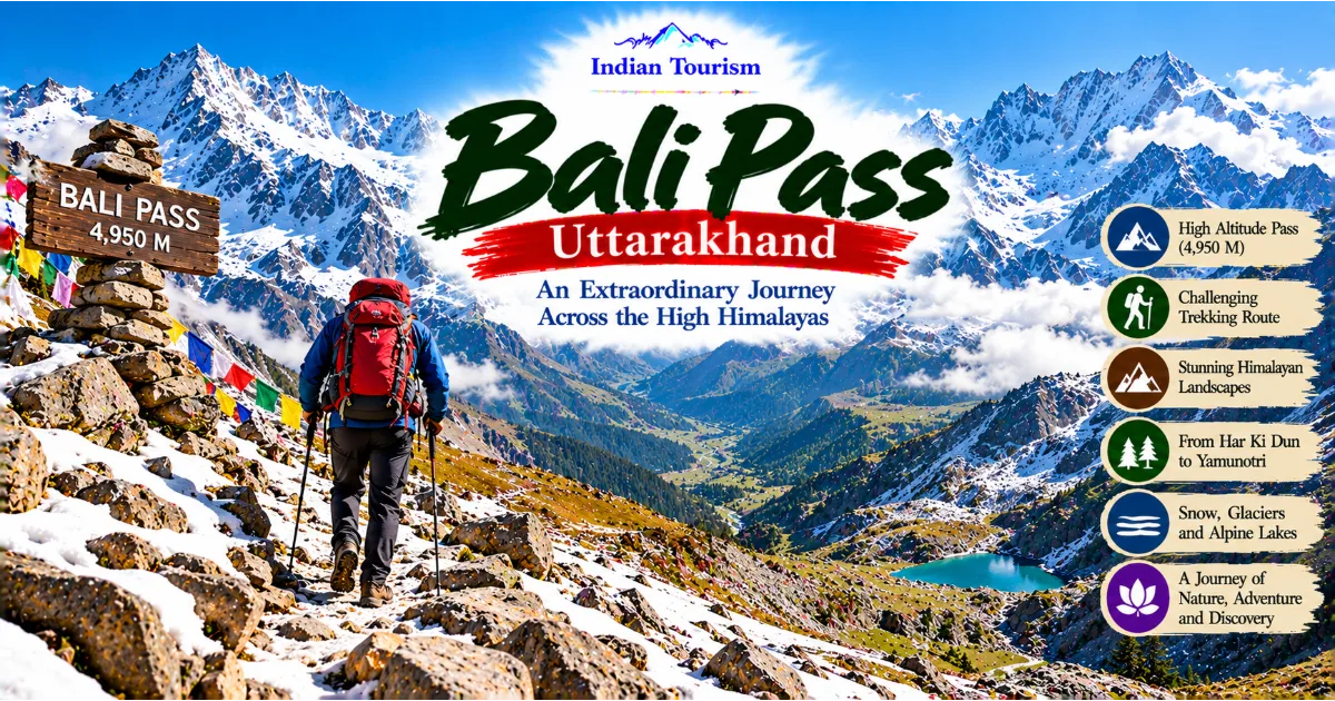
Located in Uttarakhand, Bali Pass rises to approximately 4,950 metres above sea level and connects the Har Ki Dun region with the Yamunotri region. The trek is known for its dramatic mountain scenery, demanding ascents, exposed sections, glacial terrain, and the extraordinary transition between two distinct Himalayan valleys. It is not simply a walk through beautiful landscapes. It is a journey that requires physical preparation, patience, sound judgment, and respect for the mountains.
The route takes trekkers through dense forests, traditional mountain settlements, open meadows, remote campsites, and high-altitude terrain. As the trail climbs higher, the scenery changes dramatically. The green valleys gradually give way to rocky slopes, snowfields, and rugged mountain passes. The air becomes thinner, the weather less predictable, and every step requires greater concentration.
For experienced trekkers, Bali Pass offers an opportunity to explore a less conventional route through the Garhwal Himalayas. For nature enthusiasts, it provides access to some of the region's most spectacular mountain environments. For travellers interested in Uttarakhand's geography and cultural landscape, the trek reveals how remote communities, sacred mountain regions, rivers, and valleys are connected by ancient pathways and modern trekking routes.
Continue Reading
However, Bali Pass is not suitable for everyone. Its altitude, steep gradients, challenging terrain, and potentially severe weather conditions make it a serious high-altitude undertaking. Understanding the route, choosing the right season, preparing properly, and travelling with qualified professionals when appropriate are essential parts of planning the experience.
Where Is Bali Pass Located?
Bali Pass lies in the Garhwal Himalayas of Uttarakhand, within a mountainous region associated with the Har Ki Dun valley and the upper Yamuna basin. The pass provides a high-altitude connection between these two areas, allowing trekkers to experience a remarkable geographical transition within a single expedition.
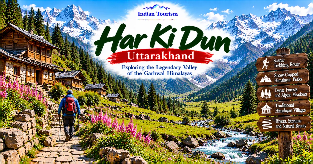
The Har Ki Dun region is known for its broad valley, forested slopes, alpine meadows, traditional settlements, and views of surrounding Himalayan peaks. It has become an important destination for trekkers seeking a combination of natural beauty, mountain culture, and relatively remote landscapes. The valley's river systems, forests, and open grasslands create an environment that feels different from the more crowded destinations of the Indian Himalayas.
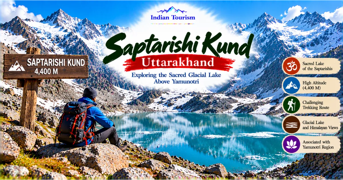
On the other side, the Yamunotri region forms part of the wider landscape associated with the Yamuna River and its Himalayan origins. The terrain here includes steep mountain slopes, rocky valleys, and high ridges that become increasingly dramatic as the trail approaches the upper reaches of the mountains.
Bali Pass brings these landscapes together. Rather than visiting one valley and returning along the same route, trekkers undertake a demanding crossing that introduces them to a different side of the Garhwal Himalayas.
The region is relatively remote compared with major tourist centres in Uttarakhand. Reaching the trailhead generally requires a road journey from the Dehradun or Uttarkashi side, followed by travel towards the appropriate starting settlement. Exact access arrangements depend on the itinerary, road conditions, local permissions, and the route selected by the trekking operator.
Travellers should not assume that road access, transport schedules, or trail conditions remain the same throughout the year. Mountain roads can be affected by landslides, heavy rainfall, snowfall, and other seasonal changes. Confirming current access information before departure is therefore essential.
Why Bali Pass Is Special
A Journey Between Two Himalayan Worlds
One of the defining characteristics of Bali Pass is the transition between the Har Ki Dun and Yamunotri landscapes. The journey allows trekkers to experience different environments within the same mountain expedition.
The Har Ki Dun side is associated with green valleys, forested approaches, meadows, and settlements shaped by generations of mountain life. As the route progresses towards the pass, the landscape becomes more exposed and increasingly dominated by rock, snow, and high mountain ridges.
Crossing the pass brings a change in perspective. The mountains appear more rugged, the slopes steeper, and the surrounding terrain more imposing. The descent towards the Yamunotri side introduces another set of valleys and mountain features.
This transition makes the trek particularly rewarding for people interested in Himalayan geography. The mountains are not simply a static backdrop. They influence the direction of rivers, the distribution of vegetation, the location of settlements, and the routes through which people have historically moved across the region.
Dramatic High-Altitude Scenery
Bali Pass is surrounded by the kind of scenery that makes high Himalayan trekking memorable. Depending on visibility, the route offers views of snow-covered summits, jagged ridgelines, broad valleys, glacially shaped terrain, and distant mountain walls.
The visual character of the landscape changes with altitude. Lower sections may feature thick vegetation, streams, and grassy clearings. Higher camps offer increasingly expansive views, with mountains appearing closer and more imposing as the route climbs.
At high altitude, the weather can transform the entire scene within minutes. A clear morning may reveal distant peaks in extraordinary detail, while afternoon clouds can obscure the surrounding ridges. Snow, mist, and shifting sunlight create different visual experiences along the same route.
Trekkers should remember that mountain views are never guaranteed. Weather conditions may limit visibility, and safety must take priority over photography or the desire to reach a particular viewpoint.
A Trek That Demands Commitment
Unlike shorter Himalayan walks, Bali Pass requires sustained effort over several days. The challenge comes not only from the distance covered but also from altitude, steep ascents, uneven terrain, cold temperatures, and the physical demands of moving between remote camps.
The crossing of the pass is particularly demanding. Depending on conditions, trekkers may encounter snow, loose stones, steep slopes, and exposed sections where careful foot placement becomes essential. A route that looks manageable in photographs may feel entirely different when approached in poor weather or at high altitude.
This is one reason Bali Pass is best suited to people with previous trekking experience. It rewards preparation and patience rather than speed. The ability to maintain a steady pace, manage energy, follow instructions, and recognise signs of altitude-related illness can be more important than raw physical strength.
Understanding the Route
Reaching the Har Ki Dun Region
A typical Bali Pass expedition begins by travelling from the Dehradun or Uttarkashi side towards the western Garhwal region. Trekkers generally continue by road to a trailhead settlement associated with the Har Ki Dun approach.
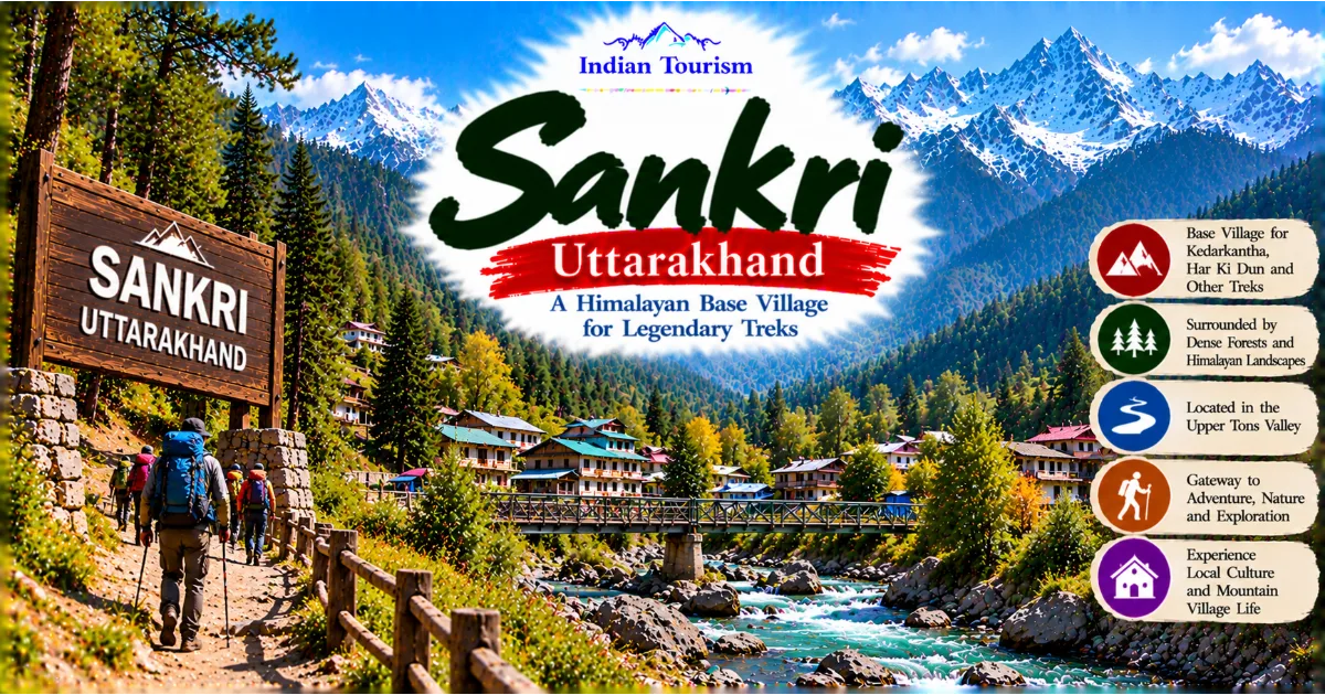
Sankri is commonly used as an access point for treks in this part of Uttarakhand. From there, the onward journey depends on the itinerary and current local arrangements.
The road journey itself introduces visitors to the changing geography of the region. Towns and villages gradually give way to forested hills, narrow valleys, river crossings, and winding mountain roads. The landscape becomes more remote as settlements grow smaller and the mountains occupy more of the horizon.
Travellers should allow sufficient time for road travel and avoid planning tight connections on the same day. Delays are common in mountainous areas, particularly during the monsoon and periods of heavy snowfall.
Walking Through Traditional Mountain Settlements
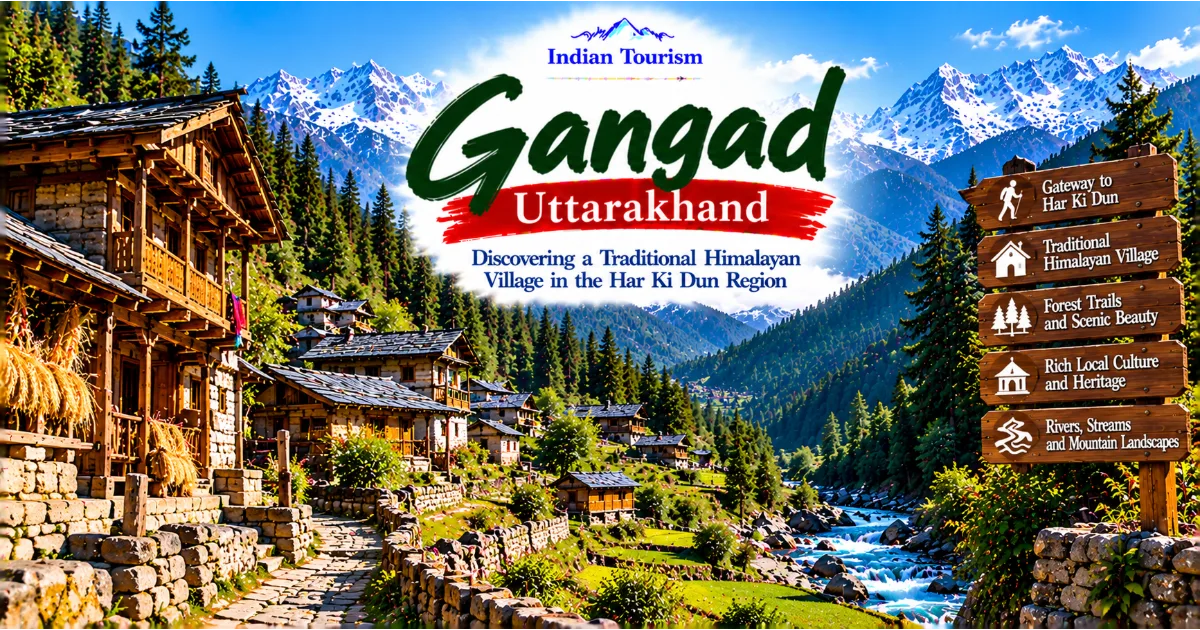
The initial trekking stages often pass through villages and settlements where everyday life remains closely connected to the surrounding landscape. Traditional houses, terraced fields, livestock, and narrow paths provide glimpses of how communities adapt to mountain conditions.
These settlements are more than convenient stopping points. They represent a cultural landscape shaped by climate, agriculture, seasonal movement, and local traditions.
Trekkers should approach village visits respectfully. Ask permission before photographing residents, avoid entering private spaces without an invitation, and purchase local goods or services where available. Carrying waste back to designated disposal points and respecting local customs helps protect the places that make the journey meaningful.
As the trail moves away from inhabited areas, the sense of remoteness becomes stronger. Forests, streams, and mountain slopes gradually replace the familiar sounds of village life.
The Har Ki Dun Valley
The Har Ki Dun valley is one of the major highlights of the broader region. Its landscape combines a broad mountain valley, green slopes, forested sections, open grasslands, and views towards surrounding peaks.
The valley is particularly attractive to travellers who appreciate the relationship between natural scenery and traditional mountain life. Depending on the season, meadows may display fresh green vegetation, wildflowers, or changing autumn colours.
The trail follows terrain shaped by rivers and mountain processes over long periods. Water flowing from the surrounding slopes supports vegetation and contributes to the ecological character of the valley.
For trekkers preparing to cross Bali Pass, this region also offers a gradual introduction to the expedition. Walking through lower and middle elevations allows the body to begin adjusting to the demands of the route, although it does not eliminate the risks associated with the much higher sections ahead.
Taking time to enjoy the valley is important. Rushing through the early stages can lead to unnecessary fatigue before the most difficult sections of the trek.
Approaching the High Camps
Beyond the main valley, the trail moves towards more remote camps and increasingly demanding terrain. Vegetation becomes less dense as elevation increases, and the landscape gradually changes from forested slopes to open mountain terrain.
Campsites are selected according to the route, weather, terrain, and the requirements of the expedition. Their exact locations and names may vary between itineraries.
At these elevations, nights can become very cold, even when daytime temperatures feel comfortable in the sun. Wind can increase the sensation of cold, while damp clothing and inadequate insulation can make conditions particularly uncomfortable.
Trekkers need appropriate sleeping equipment, layered clothing, reliable waterproof protection, and enough food and water for the demands of the route. Rest becomes increasingly important because the body works harder in an environment where oxygen availability is lower.
The high camps also provide an opportunity to assess the next day's conditions. A responsible trekking leader should consider weather forecasts, snow stability where relevant, the physical condition of participants, and the availability of a safe route before deciding whether to proceed.
The Bali Pass Crossing
The crossing itself is the central challenge of the expedition. At approximately 4,950 metres, Bali Pass lies in an environment where altitude, terrain, and weather can combine to create serious difficulties.
The ascent may involve steep slopes and sections where loose rock or snow requires careful movement. Depending on recent weather and seasonal conditions, the route may be covered by snow or may expose rocky surfaces that are difficult to negotiate.
Progress can be slow because every step requires concentration. Trekkers must conserve energy while maintaining a safe pace, follow the instructions of the expedition leader, and avoid taking unnecessary risks.
The pass should never be treated as a race or a personal challenge that must be completed regardless of conditions. Poor visibility, strong winds, unstable snow, exhaustion, or signs of altitude illness can make continuing unsafe.
Reaching the highest point can be an emotional moment. The surrounding ridges, valleys, and peaks create a powerful sense of scale, reminding visitors how small human beings are within the Himalayan landscape.
However, the summit of the pass is only part of the journey. The descent can be equally demanding and may require considerable care, particularly on steep or slippery terrain.
Descending Towards the Yamunotri Region
After crossing Bali Pass, trekkers descend towards the Yamunotri side of the mountain system. The landscape gradually changes as the route moves away from the high ridge.
Depending on the precise itinerary and prevailing conditions, the descent may include steep slopes, rocky sections, snow-covered ground, and narrow trails. These areas can place considerable strain on the knees, ankles, and leg muscles.
Descending at a controlled pace is essential. Fatigue can reduce concentration, and trekkers who rush may be more likely to slip or lose their footing.
As the trail loses elevation, the air gradually becomes denser and vegetation may become more prominent. The changing environment offers a new perspective on the relationship between high mountain terrain and the lower valleys.
The journey eventually connects with routes leading towards the Yamunotri region, where local transport and onward travel arrangements can be organised according to the expedition plan.
Because Bali Pass is a remote crossing, the itinerary should always include realistic time allowances, contingency arrangements, and a clear understanding of the intended exit route.
Best Time to Visit Bali Pass
Late Spring and Early Summer
The late spring and early summer period can offer opportunities to explore the high Himalayas before the main monsoon season. Conditions vary considerably from year to year, and snow may remain on higher sections of the route.
Snow-covered slopes can make the landscape spectacular, but they also increase the technical and safety demands of the trek. A route that is manageable in one season may be substantially more difficult in another because of snow accumulation, ice, or changing temperatures.
Trekkers considering an early-season expedition should confirm whether the pass is currently considered safe and suitable for their experience level. A qualified local operator can provide information about recent conditions, equipment requirements, and the experience needed for the planned itinerary.
Late Summer and Early Autumn
Late summer and early autumn are often considered favourable periods for high-altitude trekking in Uttarakhand, particularly when conditions are relatively stable and visibility is good. However, the timing of the monsoon and the onset of autumn weather vary from year to year.
The period following the monsoon may bring clearer views, cooler temperatures, and landscapes that retain some of their seasonal greenery. The surrounding peaks can appear especially dramatic when the air is clear.
Nevertheless, rainfall may affect lower trails, river crossings, and road access. Even when the weather seems favourable in nearby towns, conditions at the pass can be much harsher.
The best time to attempt Bali Pass should therefore be determined by current trail reports and the assessment of experienced local professionals, rather than by a fixed calendar alone.
The Monsoon Season
The monsoon presents additional difficulties in Uttarakhand. Heavy rainfall can trigger landslides, damage mountain roads, increase river levels, and make trails slippery.
Low clouds may also reduce visibility and limit the views for which the region is known. In remote areas, a minor transport or trail problem can create significant logistical challenges.
Bali Pass is not an ideal route for casual travel during unstable monsoon conditions. Trekkers should carefully evaluate official advisories and local recommendations before considering an expedition during this period.
Winter
Winter brings severe conditions to the high Himalayas. Heavy snowfall, extreme cold, strong winds, and difficult access can make the pass dangerous or inaccessible.
A winter expedition should never be treated as a simple extension of an ordinary trekking holiday. It may require specialised skills, equipment, route knowledge, and support beyond the capabilities of a standard trekking group.
For most visitors, choosing a recognised trekking season with appropriate local guidance is the more responsible approach.
Difficulty Level: Who Should Attempt Bali Pass?
Bali Pass is generally regarded as a challenging high-altitude trek. Its difficulty comes from several factors that combine to create a demanding expedition.
First, the altitude approaches 5,000 metres. At this elevation, oxygen availability is significantly lower than at sea level, and the body may struggle to adapt if the ascent is too rapid.
Second, the terrain can be steep, uneven, exposed, and affected by snow or ice. Trekkers may need to navigate narrow sections and carefully manage their balance on unstable surfaces.
Third, the expedition requires sustained effort over multiple days. Participants must be able to walk for extended periods while carrying a pack or managing the physical demands of a supported trekking arrangement.
Fourth, weather can change rapidly. Cold temperatures, wind, rain, snow, and poor visibility may affect the route and reduce the time available for safe movement.
Bali Pass is therefore best suited to trekkers who already have experience with demanding mountain routes and have demonstrated that they can handle long walking days, significant elevation gain, and challenging trail conditions.
People attempting their first Himalayan trek should generally begin with a more accessible route and build experience before considering a high pass of this nature.
Physical fitness is important, but fitness alone is not enough. Good judgment, the ability to follow safety instructions, appropriate equipment, and a willingness to turn back when necessary are equally essential.
Physical Preparation Before the Trek
Preparing for Bali Pass should begin well before the planned departure date. A structured training programme can improve endurance, leg strength, balance, and the ability to recover between demanding walking days.
Walking is one of the most useful forms of preparation. Regular walks should gradually increase in duration and difficulty, allowing the body to adapt to sustained activity. Where practical, include hills or stair climbing to build strength for ascents and descents.
Cardiovascular training can also help. Activities such as cycling, jogging, swimming, and brisk walking may improve aerobic fitness, provided the programme is suitable for the individual's health and current level of conditioning.
Strength training should focus on the muscles used during trekking. Exercises for the legs, hips, core, and calves can improve stability and reduce the strain associated with carrying a pack. Balance exercises may also be useful because mountain trails frequently involve uneven ground.
Training should progress gradually. Increasing distance, intensity, and pack weight too quickly can lead to injury before the expedition even begins.
Trekkers should also practise walking with the footwear and backpack they intend to use. This helps identify discomfort, fit problems, and equipment issues before reaching the mountains.
People with existing medical conditions or concerns about high-altitude activity should consult a qualified healthcare professional before undertaking the trek.
Understanding Altitude and Mountain Safety
High-altitude trekking carries risks that cannot be eliminated through fitness alone. Acute mountain sickness can develop when the body has insufficient time to adapt to reduced oxygen availability.
Common symptoms include headache, nausea, dizziness, fatigue, and loss of appetite. Symptoms can begin even in people who are physically fit.
More serious altitude-related illnesses can affect the lungs or brain and may become life-threatening. Warning signs include breathlessness at rest, a worsening cough, confusion, difficulty walking straight, unusual drowsiness, or a severe deterioration in overall condition.
Anyone experiencing concerning symptoms should inform the trekking leader immediately. Continuing to climb despite worsening symptoms can be dangerous. The appropriate response may include stopping the ascent, descending to a lower elevation, and seeking medical assistance.
Trekkers should never assume that a person is safe simply because they have completed difficult hikes at lower altitudes. High-altitude illness can affect experienced athletes as well as beginners.
Gradual acclimatisation, sensible pacing, adequate hydration, sufficient food, and appropriate rest can help reduce risk, but none provides complete protection.
The expedition leader should have a clear emergency plan, suitable communication arrangements, and an understanding of available evacuation options. In remote mountain regions, rescue may take time and can be affected by weather.
The decision to abandon a summit attempt or turn back from the pass should be viewed as responsible mountain judgment, not failure.
Essential Packing List for Bali Pass
Packing for Bali Pass requires careful attention to weather, altitude, terrain, and the duration of the expedition. Carrying too little equipment can create serious problems, while carrying unnecessary weight can increase fatigue.
A reliable layering system is essential. Base layers help manage moisture, insulating layers retain warmth, and an outer shell protects against wind and precipitation. A warm insulated jacket, gloves, a hat, and suitable socks are particularly important for cold conditions.
Waterproof trekking footwear with a suitable fit is necessary for uneven trails and changing terrain. The footwear should be tested before departure rather than worn for the first time on the mountain.
A properly fitted backpack should accommodate clothing, personal essentials, snacks, water, and any equipment that the trekker is responsible for carrying. Trekking poles can provide additional stability on ascents and descents.
A headlamp with spare batteries is useful because mountain days may begin before sunrise or finish later than expected. Sunglasses and high-protection sunscreen help protect against intense ultraviolet exposure at altitude.
Personal first-aid supplies should include items appropriate to the individual's needs. Prescription medicines should be carried in sufficient quantities, with a plan for keeping them accessible and protected from moisture.
A reusable water container, suitable water-treatment arrangements, personal toiletries, and waste bags are also important. Food and water requirements should be discussed with the trekking operator because the availability of supplies becomes limited in remote sections.
Specialist equipment may be required depending on the season and route conditions. This could include equipment for snow travel or other technical sections, but the exact requirements should be determined by qualified professionals who understand the current route.
Do not rely on a generic packing list alone. Ask the expedition organiser for a detailed equipment list and clarify which items will be provided, rented, or carried personally.
Wildlife, Forests, and Natural Environment
The wider Har Ki Dun and Garhwal Himalayan region supports a variety of mountain habitats. Lower elevations contain forest ecosystems, while higher areas transition into alpine vegetation, rocky terrain, and snow-covered environments.
Forested sections may include different species of broadleaf trees and conifers, depending on elevation, moisture, and local conditions. As the trail climbs, tree cover gradually gives way to shrubs, grasses, and smaller alpine plants.
Seasonal flowers can add colour to meadows and open slopes. These plants are adapted to short growing seasons and changing temperatures, making the alpine environment particularly sensitive to disturbance.
Wildlife inhabits the broader region, although sightings are never guaranteed. Animals often avoid heavily used trails, and many species are most active when human activity is limited.
Trekkers should observe wildlife from a distance and never attempt to feed, chase, or approach animals. Food waste should not be left at campsites because it can attract wildlife and alter natural behaviour.
The environment around Bali Pass is especially vulnerable because vegetation grows slowly at high elevations and damaged ground may take a long time to recover.
Visitors should remain on established routes where possible, avoid trampling fragile plants, and leave stones, flowers, and other natural features undisturbed.
The Cultural Landscape of the Garhwal Himalayas
The Garhwal Himalayas are not defined by scenery alone. They are also home to communities whose traditions, livelihoods, and identities have developed in close relationship with the mountains.
Agriculture, livestock rearing, seasonal movement, forest resources, and religious traditions have shaped life in the region for generations. Mountain paths connect settlements to fields, grazing areas, markets, and places of spiritual significance.
The Har Ki Dun region and the wider Yamunotri landscape form part of a culturally rich area where natural features are often connected with local stories and religious beliefs.
For travellers, these cultural dimensions provide a deeper understanding of the landscape. A village is not simply a starting point for a trek, and a mountain valley is not merely a scenic attraction. Both are part of a living environment in which people continue to work, worship, raise families, and adapt to changing conditions.
Responsible tourism should recognise this relationship. Trekkers can support local livelihoods by using legitimate local services, respecting community rules, and treating residents as hosts rather than attractions.
Learning a few basic greetings, asking before taking photographs, and showing patience during interactions can help create positive experiences.
Visitors should also avoid making assumptions about local traditions based on limited encounters. The communities of Uttarakhand are diverse, and practices may vary between villages and regions.
Photography Opportunities Along the Route
Bali Pass offers numerous opportunities for landscape photography, from forested trails and river valleys to high ridges and snow-covered mountain scenery.
Lower sections are well suited to photographs that capture the relationship between villages, vegetation, and the surrounding hills. Images of footpaths, terraced fields, streams, and traditional buildings can communicate the character of the region without relying only on dramatic mountain views.
As the trek progresses, the scenery becomes more expansive. Wide-angle photographs can capture the scale of the valleys and mountain walls, while longer focal lengths may help bring distant ridges and peaks into the frame.
Changing light is particularly important in the Himalayas. Early mornings may offer clear views before clouds develop, while late afternoon sunlight can emphasise the textures of rocky slopes and snowfields.
At the pass, photography should never distract from safety. Exposed ridges, strong winds, slippery surfaces, and cold conditions can make it dangerous to stop in unsuitable locations.
Protect camera equipment from moisture and sudden temperature changes. Batteries may lose charge more quickly in cold weather, so keeping spare batteries warm can be useful.
A camera is not necessary to appreciate the experience. Sometimes the most meaningful way to enjoy a mountain landscape is simply to stop at a safe location, observe the surroundings, and take in the silence.
Sustainable Tourism and Responsible Trekking
The growing popularity of Himalayan trekking brings economic opportunities but also creates environmental challenges. Waste, trail erosion, pressure on water resources, and poorly managed campsites can damage fragile mountain environments.
Bali Pass requires particular care because the route enters remote terrain where waste collection and emergency support may be limited.
Trekkers should carry out all non-biodegradable waste and follow the waste-management procedures established by their expedition organiser. Plastic wrappers, batteries, tissues, and other rubbish should never be left beside trails or streams.
Water sources must be protected from contamination. Toilets and sanitation facilities should be used according to local arrangements, and waste should not be disposed of in rivers or lakes.
Group size and campsite practices also matter. Responsible operators should minimise unnecessary disturbance, avoid damaging vegetation, and follow applicable local regulations.
Hiring local guides and support staff can help distribute tourism income to nearby communities. However, responsible hiring also means ensuring that workers have appropriate equipment, fair working conditions, and safe workloads.
Trekkers should be cautious of operators who promise a guaranteed crossing regardless of weather or participant condition. A responsible expedition leader must be prepared to change the plan when safety requires it.
The long-term appeal of Bali Pass depends on protecting the environment and respecting the people who live in the surrounding region.
Planning Your Bali Pass Expedition
A successful Bali Pass expedition begins with realistic planning. Before booking, assess your trekking experience, physical conditioning, available time, and comfort with high-altitude environments.
Choose an itinerary that allows adequate acclimatisation and does not rely on unrealistically short walking days. Confirm the intended route, expected camping locations, exit arrangements, and contingency plans.
Ask the operator about guide qualifications, group size, emergency communication equipment, first-aid provisions, and procedures for responding to altitude-related illness. Clarify whether technical equipment is required and who will provide it.
Travel arrangements should include flexibility for delays. Mountain roads and weather conditions may change unexpectedly, and rushing to meet a fixed onward connection can create unnecessary pressure.
Permits, registrations, and other local requirements may vary according to current regulations and the route used. Verify these requirements before travelling and carry the necessary identification and documents.
Travel insurance deserves particular attention. Ordinary policies may exclude high-altitude trekking, mountaineering activities, or helicopter evacuation. Read the policy carefully and confirm that the intended activity and elevation are covered.
A reasonable budget should account for transport, accommodation, trekking services, equipment, meals, insurance, and a contingency allowance. Costs vary by operator, itinerary, group size, and the level of support provided.
Finally, be willing to change your plans. The mountains do not follow a fixed schedule, and the safest expedition is one that allows conditions to determine what is possible.
Nearby Experiences to Consider
Bali Pass is part of a wider landscape that offers several opportunities for travellers interested in the Garhwal Himalayas. The Har Ki Dun valley is an important destination in its own right, attracting trekkers who want to experience alpine scenery and traditional mountain settlements without necessarily crossing a high pass.
The Govind Pashu Vihar region is also significant for its protected mountain environments and ecological diversity. Travellers interested in conservation can learn about the importance of forests, wildlife habitats, and alpine ecosystems in the western Garhwal Himalayas.
The Yamunotri region offers a different kind of experience, combining mountain scenery with pilgrimage traditions associated with the Yamuna River. Visitors should distinguish between the high-altitude trekking route and the more established pilgrimage approaches, as they involve different levels of difficulty and different travel arrangements.
These destinations can be considered separately or as part of a broader exploration of Uttarakhand, depending on available time and experience.
However, Bali Pass should not be combined casually with other demanding activities simply to fit more places into one trip. The expedition requires enough time for acclimatisation, recovery, and safe movement through remote terrain.
Is Bali Pass Worth Visiting?
For experienced trekkers who are prepared for the physical and logistical demands, Bali Pass can be an exceptionally rewarding Himalayan adventure.
Its appeal lies in the complete journey rather than a single viewpoint. The trek begins in landscapes shaped by forests, rivers, and village life before progressing into increasingly rugged mountain terrain. The high crossing creates a dramatic geographical transition, while the descent towards the Yamunotri region reveals another side of the Garhwal Himalayas.
The experience can deepen a traveller's understanding of mountain environments. It demonstrates how elevation influences weather, vegetation, physical performance, and the movement of people through the landscape.
At the same time, Bali Pass is not a destination that should be approached without preparation. High altitude, exposed terrain, rapidly changing weather, and the remoteness of the route demand respect.
For those who have already developed sound trekking skills, the pass offers an opportunity to test their abilities while experiencing a remarkable part of Uttarakhand. For beginners, it can serve as an inspiring future goal after gaining experience on easier routes.
The most important measure of success is not simply reaching the highest point. It is completing the journey with good judgment, respecting the natural environment, supporting local communities, and returning safely.
Conclusion: A Journey Into the Heart of the Garhwal Himalayas
Bali Pass represents the adventurous spirit of Uttarakhand. It connects two distinctive Himalayan regions through a route defined by changing landscapes, demanding trails, and extraordinary mountain scenery.
From the forests and meadows associated with the Har Ki Dun valley to the rugged slopes of the high pass and the descent towards the Yamunotri region, the journey reveals the diversity of the Garhwal Himalayas. Each stage offers a different perspective on the relationship between mountains, rivers, vegetation, and human settlement.
The trek also reminds visitors that remote landscapes require careful preparation and responsible behaviour. Fitness, suitable equipment, acclimatisation, reliable guidance, and a willingness to respond to changing conditions are essential elements of a safe expedition.
Bali Pass is not simply another destination to add to a travel checklist. It is a demanding mountain crossing that rewards patience, experience, and respect for the natural world.
For travellers who are ready for the challenge, it offers a memorable opportunity to discover the grandeur of Uttarakhand beyond its familiar tourist centres. The mountains may test every step, but they also provide something difficult to find elsewhere: a profound sense of scale, solitude, and connection with the Himalayan landscape.
#IndianTourism #UttarakhandTourism #BaliPass #GarhwalHimalayas #HimalayanTrekking #AdventureTravelIndia #HarKiDun #Yamunotri #MountainTravel #ResponsibleTourism #ExploreUttarakhand #IncredibleIndia