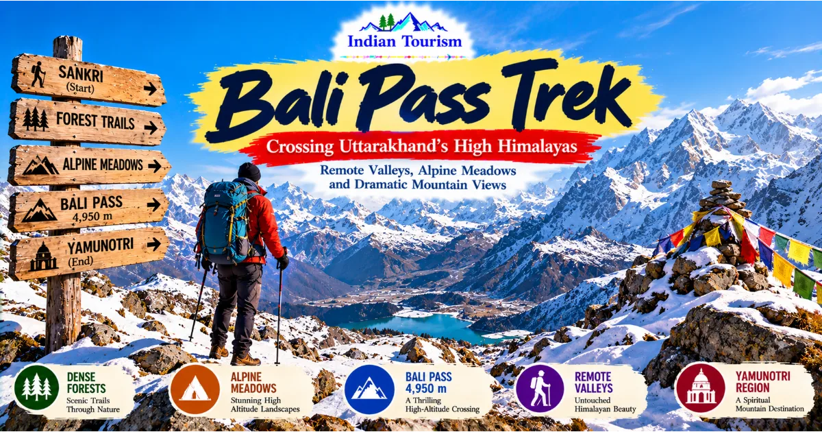
The Bali Pass Trek is a challenging Himalayan adventure in Uttarakhand that connects the Har Ki Dun region with the Yamunotri side of the Garhwal Himalayas.
Reaching an elevation of approximately 4,950 metres, this high-altitude route offers dramatic mountain views, remote valleys, alpine meadows, glaciers, and a demanding crossing for experienced trekkers.
It is particularly suited to adventurers seeking a journey beyond conventional trekking routes and a deeper experience of Uttarakhand's high mountain wilderness.
Introduction: An Adventure Beyond Ordinary Himalayan Trails
The Garhwal Himalayas contain some of India's most remarkable trekking landscapes. While destinations such as Kedarkantha and Har Ki Dun attract visitors with their forests, villages, and accessible mountain scenery, the Bali Pass Trek offers a more demanding experience. It takes trekkers into a high-altitude environment where preparation, endurance, route knowledge, and respect for changing mountain conditions become essential.
Bali Pass is located in Uttarkashi district, Uttarakhand, and forms part of a trekking corridor connecting the upper Tons River region with the Yamunotri area. The route is commonly approached from the Sankri side and descends towards the Yamunotri region, although itineraries and trail conditions can vary. The pass itself lies at approximately 4,950 metres above sea level, where thin air, cold temperatures, steep terrain, and unpredictable weather can make progress difficult.
The trek is not simply a walk between two valleys. It is a gradual transition through forests, traditional settlements, open meadows, rocky mountain terrain, and high-altitude landscapes. As trekkers gain elevation, the vegetation becomes less dense, the air grows colder, and the surrounding peaks appear increasingly imposing. The final approach to the pass demands careful movement and close attention to local guidance.
Continue Reading
For travellers who enjoy remote landscapes and physically demanding journeys, Bali Pass offers a powerful introduction to the more challenging side of Himalayan trekking. However, its appeal should never overshadow its risks. This route requires appropriate preparation, experienced support, suitable equipment, and a willingness to change plans when conditions become unsafe.
Where Is Bali Pass Located?
Bali Pass lies in the Garhwal Himalayas of Uttarakhand, within the wider mountain region associated with the upper Tons valley and the Yamunotri area. It connects two distinct Himalayan landscapes, allowing trekkers to experience changes in terrain, vegetation, and settlement patterns during one journey.
The western side of the route is associated with the Sankri trekking region, which serves as a starting point for several well-known trails in Uttarkashi district. The eastern side leads towards the Yamunotri region, an area known for its mountain scenery and religious significance. The precise route followed depends on the itinerary selected by the trekking operator and the conditions prevailing during the season.
The pass reaches approximately 4,950 metres above sea level. At this elevation, oxygen availability is lower than at sea level, and physical exertion can feel considerably more difficult. Even experienced hikers need time to adjust to increasing altitude, while weather conditions may change rapidly around exposed ridges and high mountain slopes.
Bali Pass is not a destination that can be reached by road. Travellers must complete a multi-day trek through remote terrain, with overnight stops determined by the route plan and local conditions. Facilities become increasingly limited as the trail moves away from established settlements.
The surrounding region includes forests, rivers, meadows, steep slopes, and high mountain terrain. Its variety is one of the main reasons the trek attracts experienced adventurers. Rather than presenting one landscape throughout the journey, Bali Pass reveals several different Himalayan environments as trekkers progress towards the crossing.
Understanding the Bali Pass Trek Route
A Bali Pass itinerary usually begins in the Sankri region and follows trails through the upper Tons valley before approaching the high mountain crossing. The route then descends towards the Yamunotri side, eventually connecting with settlements and road access according to the chosen itinerary.
The exact route, campsites, daily distances, and total duration can differ between trekking operators. Weather, snow conditions, trail damage, river levels, and local restrictions may also require changes. Travellers should therefore confirm the current route with an experienced operator rather than relying entirely on an old itinerary.
The early stages typically introduce trekkers to the forests and mountain villages of the region. These sections provide opportunities to become familiar with the terrain while gradually building the physical rhythm required for several consecutive days of walking. River valleys and wooded slopes create a landscape that feels very different from the exposed terrain encountered higher up.
As the route gains elevation, forests begin to give way to more open mountain environments. Meadows, rocky slopes, and views of surrounding peaks become increasingly prominent. The trail may involve uneven surfaces, steep ascents, narrow sections, and changing ground conditions.
The approach to Bali Pass is among the most demanding parts of the journey. Depending on the season, snow and ice may affect movement, and steep slopes can require specialist equipment and experienced guidance. Trekkers should not assume that a route is safe simply because it has been completed successfully by other groups.
The descent towards the Yamunotri region presents its own challenges. Long downhill sections can place considerable strain on the knees and ankles, particularly after the physical effort required to cross the pass. A realistic itinerary must account for the demands of both the ascent and descent.
Why Bali Pass Is Considered a Challenging Trek
Bali Pass is generally regarded as a demanding high-altitude trek rather than a beginner-friendly hiking route. Its elevation, remote setting, steep terrain, and exposure to changing weather make it significantly more challenging than many shorter Himalayan walks.
One of the main difficulties is the altitude. At approximately 4,950 metres, the body must work harder to obtain the oxygen it needs. Walking uphill can become tiring even for physically fit people, and recovery may take longer than expected. A person's response to altitude cannot be predicted solely from their general fitness.
The route may also involve long walking days. Trekkers can face sustained ascents, uneven ground, rocky passages, and descents that require concentration even when fatigue begins to build. Carrying a heavy backpack can make these challenges more difficult, which is one reason equipment planning matters.
Weather adds another layer of uncertainty. Temperatures can fall sharply, strong winds can make exposed sections uncomfortable, and snowfall or rain can affect visibility and footing. Conditions at the pass may differ considerably from those experienced in the lower valley on the same day.
Remote terrain also affects emergency response. Medical assistance, transport, and communication may not be immediately available. A minor injury can become more serious when a group is far from road access, while a sudden change in weather may require an itinerary to be altered.
The correct approach is to treat Bali Pass as a serious mountain undertaking. Preparation should include physical training, suitable equipment, an appropriate acclimatisation plan, experienced leadership, and an understanding that reaching the pass is never more important than returning safely.
The Landscape of the Upper Tons Valley
The upper Tons valley forms an important part of the trekking landscape on the Sankri side of Bali Pass. Its combination of forests, river systems, mountain settlements, and rising slopes creates a natural corridor into the higher Himalayas.
The lower sections of the route often feature wooded terrain, where tall trees and dense vegetation frame the walking trail. The sound of streams and rivers accompanies parts of the journey, while clearings reveal views of surrounding ridges. The landscape changes gradually rather than all at once, giving trekkers time to observe the relationship between the forest and the mountains.
As the trail moves higher, the valley opens in places to reveal broader views. The steep slopes become more visible, and the distant peaks provide a sense of the scale of the surrounding mountain system. Weather and light can transform these views throughout the day.
The river environment is especially important to the region. Mountain streams carry water through the valleys, supporting vegetation and contributing to the wider river system. Their appearance can change with rainfall, snowmelt, and the season.
Visitors should not approach streams or river crossings casually. Water levels can rise rapidly, and a crossing that appears manageable from a distance may be unsafe. Trekkers should follow local instructions and avoid entering fast-flowing water without appropriate guidance.
The upper Tons valley is more than a scenic approach to a mountain pass. It is an interconnected environment where water, forests, settlements, and mountain weather influence both natural processes and human activity. Understanding this relationship helps visitors appreciate the region beyond its photographic appeal.
Forest Trails and the Transition to Alpine Terrain
The early forest sections of the Bali Pass Trek offer a different experience from the exposed mountain slopes encountered at higher elevations. Trees provide shade, vegetation creates a sense of enclosure, and the trail follows terrain shaped by streams, slopes, and centuries of natural change.
The composition of the forest varies with elevation, local conditions, and exposure. Some sections may be dominated by tall conifers, while other areas contain mixed vegetation and smaller plants. The forest floor can be covered with leaves, roots, stones, moss, and other natural material that makes careful footing important.
Walking through the forest requires attention even when the slope appears gentle. Roots and loose stones can create uneven surfaces, particularly after rain. Trekking poles may help some visitors maintain balance, although they do not replace suitable footwear or careful movement.
Higher along the route, the forest gradually becomes less continuous. Open slopes and meadows begin to dominate parts of the landscape, allowing longer views across the valley. The change is not always uniform, as vegetation patterns depend on terrain and local conditions.
The transition to alpine environments is one of the most memorable aspects of high-altitude trekking. It demonstrates how temperature, exposure, soil, and the length of the growing season influence plant life. Trees that thrive at lower elevations cannot grow indefinitely as the environment becomes colder and more exposed.
Travellers should avoid creating shortcuts through vegetation or damaging plants for photographs. Alpine environments can be sensitive to disturbance, and recovery may be slow where growing conditions are harsh. Remaining on established paths helps reduce unnecessary damage.
Alpine Meadows and Open Mountain Views
Alpine meadows are among the visually appealing landscapes that trekkers may encounter on routes approaching Bali Pass. These open areas can offer broad views of mountain slopes and ridges, creating a strong contrast with the enclosed forest trails below.
The appearance of a meadow depends heavily on the season. During periods of active growth, grasses and flowering plants may add colour to the landscape. At other times, the ground may appear dry, muted, or covered by snow. Travellers should understand that the same location can look very different from one month to another.
Meadows are not empty spaces. They provide habitat for plants and small animals, contribute to the wider mountain ecosystem, and may be connected to seasonal grazing practices in the region. Their ecological value extends beyond the views they offer visitors.
Trekkers should avoid trampling large areas to reach a preferred photography angle. They should also refrain from picking wildflowers or removing plants as souvenirs. The best way to appreciate an alpine meadow is to observe it without damaging the environment.
The open landscape also brings greater exposure to wind and changing weather. A sunny morning can become cold when clouds move in, and exposed sections may feel uncomfortable when strong winds develop. Warm layers and weather protection should remain accessible rather than buried at the bottom of a backpack.
For photographers, open meadows can provide opportunities to capture the contrast between green or rocky slopes and snow-covered peaks. For other travellers, they offer space to pause, observe the surroundings, and appreciate the scale of the Himalayan landscape.
The High-Altitude Approach to Bali Pass
The final approach to Bali Pass is the defining challenge of the trek. By this stage, trekkers have already travelled through several mountain environments and may have accumulated fatigue from previous walking days. The combination of elevation, steep terrain, cold temperatures, and exposure requires a cautious approach.
At approximately 4,950 metres, the pass lies well above the elevations of most Indian hill stations. Breathing becomes more difficult during exertion, and walking pace may need to be slower than expected. Trying to maintain the speed used at lower elevations can lead to exhaustion.
The terrain near the crossing can vary considerably with the season. Snow, ice, loose rock, and steep slopes may affect movement. The presence of snow does not automatically make a route impassable, but it changes the skills and equipment needed to travel safely.
Experienced local guides are particularly important in this environment. They can assess route conditions, help determine whether the crossing is appropriate, and advise when a group should wait or turn back. Their judgement should take priority over pressure to complete a planned itinerary.
Trekkers must understand that high-altitude conditions can affect decision-making as well as physical performance. Fatigue and the effects of altitude may make it harder to recognise risk. Regular communication within the group and careful monitoring of each participant are essential.
Reaching the pass can be a memorable achievement, but it should never become the sole measure of success. Turning back because of unsafe conditions is a sign of responsible mountain judgement. The Himalayas reward patience and preparation, not unnecessary risk-taking.
Mountain Peaks and Himalayan Panoramas
The wider Garhwal Himalayas are known for dramatic peaks, deep valleys, and high ridgelines. During the Bali Pass Trek, the changing elevation provides opportunities to observe these features from different perspectives.
From forested sections, mountains may appear in partial views through trees or across the valley. Higher up, the landscape becomes more open, and ridgelines can dominate the horizon. Snow-covered peaks may stand out against clear skies, while clouds can conceal and reveal different sections of the mountains throughout the day.
The visual experience depends on weather and visibility. A clear day may offer extensive views, while mist or cloud can reduce the landscape to nearby slopes and fragments of distant peaks. Travellers should avoid treating clear weather as guaranteed, especially in a high mountain environment.
The mountains also create their own weather patterns. Wind may strengthen around exposed ridges, and clouds can develop as air moves across the terrain. Conditions may change more quickly than travellers expect from observing the sky in a lower valley.
Photography is rewarding in these environments, but it should not distract from safety. Visitors should never move close to unstable edges or step onto unfamiliar ground simply to obtain a dramatic image. Camera equipment should be secured in a way that allows hands to remain available for balance when necessary.
The greatest value of the panoramic experience is not only the photograph taken at a particular point. It is the understanding that the route passes through a vast and interconnected mountain landscape, where each valley and ridge forms part of a larger geographical system.
Wildlife and Biodiversity Along the Route
The forests and high mountain environments around Bali Pass form part of the wider ecological landscape of Uttarakhand. Different elevations support different forms of vegetation and provide habitats for birds, mammals, insects, and other wildlife adapted to Himalayan conditions.
Wildlife sightings cannot be guaranteed. Animals may remain hidden, move through areas away from the trekking trail, or avoid places where people are present. Travellers should therefore appreciate the environment without expecting to see a particular species.
Birdwatchers may find the changing vegetation especially interesting. Forests, open slopes, and higher mountain terrain can support different bird communities. Observing quietly and learning to recognise calls can provide a rewarding experience even when birds are difficult to photograph.
The ecological importance of the region makes responsible behaviour essential. Feeding wild animals can change their natural behaviour and encourage them to approach people. Leaving food waste behind can attract animals to campsites and create problems for both wildlife and trekkers.
Visitors should never attempt to approach, chase, touch, or corner an animal. If wildlife is encountered, maintaining distance and following guide instructions is the safest response. Photographs should be taken only when they can be obtained without disturbing the animal or putting people at risk.
The mountain ecosystem also includes less visible forms of life. Plants, soil organisms, insects, and natural water systems contribute to ecological processes that may not be immediately apparent to visitors. Protecting the environment requires attention to these interconnected elements rather than focusing only on large or visually appealing species.
A responsible trek leaves the landscape as undisturbed as possible and recognises that wildlife has a right to exist independently of human tourism.
Traditional Villages and Local Culture
The settlements connected with the Bali Pass route provide an important cultural dimension to the journey. Villages in the upper Tons region reflect generations of adaptation to mountain geography, seasonal weather, agricultural needs, and limited access to distant markets.
Traditional buildings often use locally available materials and designs suited to the environment. Stone and timber may be important elements of older structures, while newer construction reflects changing materials, resources, and household needs. The appearance of a village therefore tells a story about both continuity and change.
Agriculture and livestock management remain part of the identity of many mountain communities. The work involved varies with the season and the conditions of individual households. Travellers may see cultivated plots, storage areas, animals, and other features connected to everyday rural life.
Visitors should remember that villages are living communities rather than attractions created exclusively for tourism. Residents may be working, caring for family members, managing livestock, or carrying out tasks that require concentration. Respectful behaviour means avoiding intrusive photography and asking permission before photographing people or private spaces.
Local guides can help visitors understand the region's history, customs, and practical realities. Their knowledge may include information that cannot be gained from a map or a short description of the route. Hiring reputable local services can also contribute to the livelihoods of people who support trekking in the area.
Cultural curiosity is most useful when combined with humility. Not every resident will wish to speak with visitors, and local traditions may differ between communities. Listening carefully and avoiding assumptions help create more meaningful interactions.
The Yamunotri Side of the Journey
One of the distinctive aspects of the Bali Pass Trek is its connection with the Yamunotri region. The route links the upper Tons valley with a landscape associated with the source region of the Yamuna River and an important Hindu pilgrimage destination.
Yamunotri is one of the four sites traditionally included in the Char Dham pilgrimage circuit of Uttarakhand. The pilgrimage destination is associated with the Yamuna River and holds religious significance for many devotees. Its cultural identity adds another dimension to the geographical journey across the mountains.
The Bali Pass route does not simply deliver trekkers to a viewpoint and then return them to their starting point. Depending on the itinerary, it takes them into a different valley system, allowing them to experience changes in terrain and the relationship between mountain settlements and religious landscapes.
The Yamunotri region also demonstrates how the Himalayas are important for reasons beyond adventure tourism. Rivers descending from the mountains support communities and ecosystems far downstream, while sacred sites connect geography with cultural memory and religious practice.
Travellers should treat pilgrimage areas respectfully. Religious sites may have particular expectations regarding behaviour, clothing, photography, and access. Following local instructions helps protect both cultural traditions and the experience of other visitors.
The connection between Bali Pass and the Yamunotri side makes the trek particularly interesting for people who want to understand the wider geography of Uttarakhand. It offers a journey between two landscapes that share a Himalayan setting but have distinct local characteristics and cultural associations.
Best Time to Attempt the Bali Pass Trek
The suitable season for Bali Pass depends on weather, snow conditions, the experience of the trekking group, and the route's current accessibility. The pass is a high-altitude environment, so seasonal decisions should be made with current local advice rather than a fixed calendar alone.
Late spring and summer may provide opportunities for trekking as conditions develop after winter. However, snow can remain at higher elevations, and the route may still require specialised equipment and experienced support. Conditions vary from year to year.
The monsoon period introduces additional concerns in Uttarakhand. Heavy rain can make lower trails slippery, increase the risk of landslides and falling rocks, and raise river levels. Cloud cover can reduce visibility, while wet conditions may make steep terrain more difficult to navigate.
Early autumn is often considered for high-altitude trekking because conditions may become more stable after the main monsoon period. Even then, temperatures can fall sharply at night, and snow or sudden weather changes remain possible in high mountain areas.
Winter conditions can make the pass significantly more demanding or unsuitable for ordinary trekking itineraries. Snow and ice can complicate navigation, while cold temperatures and limited daylight increase the consequences of poor planning.
No season guarantees a successful crossing. Travellers should confirm current access, weather forecasts, snow conditions, and any local restrictions before departure. A responsible operator will be prepared to change the itinerary or cancel the crossing if the risks become unacceptable.
The right time to trek is not simply the month with the most attractive photographs. It is the period when the route is suitable for the group's experience, equipment, and safety requirements.
Physical Training and Acclimatisation
Preparation for Bali Pass should begin well before the departure date. The trek combines sustained walking, steep ascents, long descents, and high-altitude exertion. Regular physical activity can improve readiness, but it cannot eliminate the effects of altitude.
Training may include brisk walking, uphill hikes, stair climbing, cycling, and exercises that strengthen the legs and core. The routine should increase gradually so the body has time to adapt. People who are not accustomed to long walks should begin with manageable distances and build consistency before attempting more demanding sessions.
Practising with a loaded backpack can help identify problems with fit and weight distribution. Footwear should be tested before the trek, and any rubbing or discomfort should be addressed early. Blisters can become a serious inconvenience when walking for several consecutive days.
Acclimatisation is equally important. A well-designed itinerary allows the body time to adjust as elevation increases. Trekkers should not assume that strong fitness protects them from altitude-related illness. Symptoms can occur in healthy people, and individual responses vary.
Headache, nausea, unusual fatigue, dizziness, and disturbed sleep may be associated with altitude exposure. More serious warning signs can include confusion, difficulty walking straight, breathlessness at rest, or a rapid deterioration in condition. These symptoms require immediate attention and may require descent and medical assistance.
Trekkers should communicate honestly about how they feel rather than hiding symptoms to avoid delaying the group. Guides and group leaders need accurate information to make safe decisions.
Physical training, gradual ascent, appropriate rest, hydration, and careful monitoring work together to reduce risk. None of these measures guarantees safety, which is why conservative decision-making remains essential throughout the journey.
Essential Equipment for Bali Pass
The equipment required for Bali Pass depends on the season, current route conditions, and the support arrangements. Because the route reaches high altitude and may involve snow or ice, a generic day-hiking packing list is not sufficient.
Layered clothing helps trekkers adapt to changing temperatures. A moisture-managing base layer, insulating layers, and a suitable outer shell provide more flexibility than relying on a single heavy garment. Warm gloves, headwear, and additional insulation may be necessary in cold or exposed conditions.
Footwear should provide suitable support and grip for the terrain. The correct type depends on the route and the equipment required for the season. Shoes or boots should be tested before departure rather than worn for the first time on the trek.
Technical equipment may be necessary when snow and ice are present. Depending on conditions, this can include traction devices, an ice axe, a climbing helmet, or other specialist equipment. Such equipment is useful only when it is appropriate for the route and the user knows how to use it. Follow the advice of a qualified guide and do not attempt technical terrain without the required training.
A headlamp, spare batteries, personal medication, first-aid supplies, blister treatment, sun protection, and a reliable means of carrying water are also important considerations. A power bank may be useful, although it should not be treated as a substitute for a proper emergency communication plan.
The backpack should remain as light as practical while containing essential safety items. Travellers should confirm what is supplied by the trekking operator and what they must carry themselves. Unclear arrangements can lead to unnecessary weight or missing equipment.
Before setting out, check all equipment carefully. The high mountains are not an appropriate place to discover that a waterproof layer leaks, footwear causes severe blisters, or essential equipment has been left behind.
Food, Hydration, and Energy Management
Multi-day trekking requires consistent energy intake. The demands of climbing, descending, and walking at altitude can reduce appetite while increasing the body's need for fuel. Planning meals and snacks helps prevent avoidable exhaustion.
Food arrangements depend on the trekking itinerary and the support available along the route. Trekkers may receive meals through an organised trekking service or make arrangements with local providers where available. Because facilities become limited in remote sections, visitors should confirm the food plan in advance.
Simple meals containing carbohydrates, protein, and other essential nutrients can support sustained activity. Small snacks may be useful during walking breaks, particularly when the group is travelling for several hours. Individual dietary needs should be discussed before departure.
Hydration is important, but the availability of safe water cannot be assumed. Water should be treated or obtained from a source confirmed to be safe. Clear mountain water may still contain microorganisms that can cause illness.
Cold weather can reduce the sensation of thirst, making it easy to drink less than needed. Trekkers should pay attention to hydration throughout the day and follow appropriate guidance from their trekking team.
Energy management also depends on pacing. Walking too quickly early in the day can cause fatigue that becomes difficult to recover from later. A steady pace, regular breaks, and communication with the group help maintain a more sustainable rhythm.
Alcohol and other substances that impair judgement are inappropriate during a high-altitude trek. Rest, nutrition, hydration, and sensible pacing support safer decisions and a more enjoyable experience.
Accommodation and Campsite Considerations
Accommodation on the Bali Pass route is generally basic compared with established tourist destinations. The itinerary may involve campsites or other overnight arrangements depending on the route and the services provided by the trekking operator.
Travellers should confirm what is included in their package. Sleeping equipment, meals, tents, support staff, and other services may differ between operators. Assumptions based on another trek or a different season can lead to unnecessary confusion.
Cold nights are an important consideration at high elevations. A suitable sleeping system must match the expected temperatures and conditions. The operator should be able to explain the equipment provided and what additional personal items are required.
Campsites should be used according to local rules and the guidance of the trekking team. Campers should avoid damaging vegetation, leaving food waste, or disturbing nearby water sources. Waste should be collected and carried out for appropriate disposal.
Quiet behaviour is especially valuable in remote mountain environments. Loud music and unnecessary noise can disturb wildlife and reduce the sense of calm that many travellers seek. Respect for other trekkers is equally important when sharing limited camping space.
Accommodation arrangements may need to change when weather or route conditions deteriorate. Trekkers should understand that safety may require stopping at a different location, shortening a walking day, or abandoning the planned crossing.
A flexible attitude is essential. In the high Himalayas, a successful trip depends not on receiving every expected comfort but on having appropriate support and making sensible decisions as conditions change.
Responsible Tourism and Environmental Protection
The natural landscapes around Bali Pass are part of a wider Himalayan environment that supports wildlife, vegetation, water systems, and mountain communities. Responsible tourism helps reduce the effects of trekking and protects the character of the region.
All rubbish should be carried out and disposed of appropriately. Food wrappers, plastic bottles, batteries, and other waste should never be left on the trail or buried at campsites. Small amounts of litter can accumulate when many groups follow the same route.
Trekkers should stay on established paths wherever possible. Creating shortcuts can damage fragile vegetation and increase erosion. This is especially important in exposed mountain terrain where plants may grow slowly and recovery can take a long time.
Wildlife should be observed from a distance. Feeding animals or leaving food scraps can change their behaviour and attract them to campsites. Visitors should never attempt to approach animals for photographs.
Water sources need protection. Avoid washing with soaps or detergents directly in streams, and follow the trekking team's guidance about sanitation and waste management. Clean water is essential for both ecosystems and communities.
Campfires should never be started unless they are explicitly permitted and safe under local rules. In many mountain environments, open fires can damage vegetation, create wildfire risks, and place pressure on limited natural resources.
Responsible tourism also means supporting local livelihoods fairly. Using reputable guides, transport providers, accommodation services, and other legitimate businesses can help local communities benefit from visitors. Respecting agreed prices and local customs contributes to better relationships between travellers and residents.
The principle is straightforward: enjoy the mountain landscape while taking practical steps to reduce harm. The value of Bali Pass lies in its wilderness, and preserving that environment benefits future trekkers as well as the people and wildlife connected to it.
Common Mistakes Trekkers Should Avoid
One major mistake is treating Bali Pass as an ordinary hiking route. Its elevation, steep terrain, and remote setting require preparation beyond what is necessary for a short walk. Travellers should assess their experience honestly and choose a route suited to their abilities.
Another mistake is relying on old photographs or itineraries to judge current conditions. Snow coverage, rainfall, trail damage, and access arrangements can change significantly. Current local information is more useful than an assumption that the route will resemble a previous year's conditions.
Poor acclimatisation can also create serious problems. Trying to gain elevation too quickly or ignoring symptoms can put the entire group at risk. Trekkers should follow the planned ascent schedule and take medical warning signs seriously.
Carrying unsuitable equipment is another avoidable error. Ordinary hiking shoes may not be appropriate for technical snow or ice, while specialist equipment is of little value if the user does not know how to use it. Gear should match the actual route conditions and the experience of the group.
Some travellers underestimate the descent. After crossing a high pass, fatigue can affect concentration and balance. Steep downhill sections can strain the knees and increase the risk of slipping, particularly when the terrain is loose or wet.
Finally, visitors should avoid allowing the goal of reaching the pass to override safety. Weather, health, and terrain may require a change of plan. A summit or crossing is an objective, not an obligation.
Experienced trekkers understand that good judgement is part of the adventure. The ability to stop, wait, or turn back when necessary is a sign of competence rather than weakness.
Who Should Attempt the Bali Pass Trek?
Bali Pass is best suited to trekkers with previous experience of multi-day mountain routes and a realistic understanding of high-altitude conditions. Experience on steep terrain, comfort with carrying a backpack, and the ability to walk for several consecutive days are valuable preparation.
Physical fitness alone is not enough. A strong runner who has never trekked on uneven mountain trails may face different challenges from someone with less cardiovascular speed but extensive hiking experience. Preparation should therefore include relevant outdoor practice, not just gym workouts.
Beginners who are interested in the route should first develop their skills through less demanding treks and learn how their bodies respond to sustained walking and altitude. A qualified operator can help assess whether a person's experience is suitable for the intended itinerary.
Families should be especially careful when considering this route for children or older relatives. The difficulty, elevation, weather exposure, and limited facilities mean that the trek should not be chosen simply because it is described as scenic or adventurous. Every participant's health, experience, and needs must be considered.
Solo travellers should evaluate their navigation skills, emergency planning, and access to experienced local support. Remote high-altitude terrain is not an appropriate environment for relying on improvisation alone.
The trek may be rewarding for mountaineering enthusiasts, experienced hikers, landscape photographers, and travellers who value demanding outdoor experiences. The most important qualification, however, is a willingness to prioritise safety and adapt to the mountain environment.
Planning Your Bali Pass Adventure
A well-planned Bali Pass journey begins with choosing a suitable trekking operator and confirming the current route. Travellers should ask about the itinerary, expected walking hours, altitude profile, acclimatisation arrangements, technical sections, equipment, meals, accommodation, and emergency procedures.
The route should be appropriate for the group's experience and the conditions expected during the selected season. An itinerary that looks attractive on paper may require changes if snow, rain, or other hazards affect the crossing.
Transport to the Sankri region should be arranged with sufficient flexibility. Mountain roads can be affected by weather, traffic, landslides, and other disruptions. Avoid scheduling an essential connection immediately after the planned end of the trek without allowing time for unexpected delays.
The budget should account for transport, trekking services, equipment, meals where not included, personal supplies, and a reserve for unforeseen expenses. Costs vary with the season, group size, operator, and service level, so obtain current quotations instead of relying on old prices.
Before departure, check relevant permissions and registration requirements. These may change, and the trekking operator should explain the arrangements needed for the current route. Travellers should also share their itinerary with a trusted person and understand the available emergency communication options.
A final equipment check should take place before entering the remote sections. Confirm that essential clothing, footwear, medication, water treatment supplies, and safety equipment are available and functional.
Above all, plan with the understanding that a mountain itinerary is flexible. The ability to change the schedule, remain at a lower elevation, or abandon the crossing when conditions deteriorate is an important part of responsible trekking.
Conclusion: A Demanding Journey into the Garhwal Himalayas
The Bali Pass Trek offers a remarkable opportunity to explore the high mountain landscapes of Uttarakhand. Connecting the upper Tons valley with the Yamunotri region, the route moves through forests, meadows, remote mountain terrain, and a high-altitude crossing at approximately 4,950 metres.
Its appeal lies in the variety of landscapes and the challenge of travelling through a demanding environment. Trekkers experience the gradual transition from wooded valleys to open slopes and exposed high mountain terrain. The journey also provides a broader understanding of the geography, ecology, and cultural connections of the Garhwal Himalayas.
However, Bali Pass should never be approached casually. The elevation, weather, steep terrain, and remoteness require appropriate experience, physical preparation, equipment, acclimatisation, and reliable local guidance. Conditions can change rapidly, and reaching the pass is not worth risking a person's health or safety.
Responsible travellers prepare carefully, respect local communities, minimise environmental impact, and remain flexible when conditions require a different plan. They understand that the mountains are not obstacles to be conquered at any cost but environments that demand attention and humility.
For experienced trekkers seeking a challenging Himalayan adventure, Bali Pass can be a memorable journey through one of Uttarakhand's most dramatic mountain regions. The greatest achievement is not simply crossing the pass. It is completing the journey with sound judgement, respect for the landscape, and an appreciation of the natural and cultural world encountered along the way.