
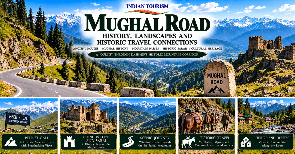
Journey Through a Historic Gateway to Kashmir
The Mughal Road is one of the most fascinating historic travel corridors associated with Jammu and Kashmir. Connecting the Poonch and Rajouri regions with the Kashmir Valley through the Pir Panjal mountains, this route brings together dramatic Himalayan scenery, historic travel traditions, local culture and the legacy of journeys made long before modern highways transformed movement across the region. Its winding mountain stretches, forested slopes, high-altitude meadows and historic stopping places tell a story that extends beyond tourism. They reveal how geography shaped political connections, trade, travel and everyday life across the mountains.
For centuries, crossing the mountains between the plains and Kashmir required considerable planning. Travellers had to negotiate steep paths, unpredictable weather, limited supplies and the physical demands of moving through high-altitude terrain. Routes through the Pir Panjal range were therefore important not simply because they connected two geographical areas, but because they influenced the movement of people, goods, information and political authority.
The Mughal Road is particularly associated with historical journeys to Kashmir during the Mughal period. Kashmir became an important destination for Mughal rulers and members of the imperial court, who travelled to the valley for its climate, landscape and strategic significance. The mountain route formed part of a wider network of roads and stopping places that helped organise these journeys.
Today, the road offers travellers an opportunity to discover a different side of Jammu and Kashmir. While Srinagar, Gulmarg, Pahalgam and Dal Lake attract attention for their scenery and tourism facilities, the Mughal Road introduces visitors to the historical geography connecting the Kashmir Valley with the Jammu region. Its significance lies in the relationship between landscape and movement, as well as the communities that continue to live along the route.
This guide explores the history of the Mughal Road, its connection with the Mughal era, the importance of Peer Ki Gali, the heritage of Chingus Fort and Sarai, the natural landscapes along the corridor and the practical considerations involved in planning a responsible journey.
Understanding the Geography of the Mughal Road
The Mughal Road crosses the Pir Panjal mountain range, which forms an important geographical barrier between the Kashmir Valley and areas to its south. The range is part of the western Himalayas and contains forests, mountain slopes, high passes and valleys that have influenced travel and settlement for generations.
The route connects the Poonch and Rajouri areas with the Kashmir Valley, providing a mountain corridor between the Jammu region and southern Kashmir. Its alignment passes through landscapes that vary considerably with altitude. Lower stretches include inhabited areas and agricultural land, while higher sections feature dense forests, open mountain scenery and exposed terrain.
The road's geography explains much of its historical importance. Mountain ranges can make movement difficult, but they do not necessarily prevent contact between communities. Passes and valleys create natural corridors that people can use when conditions permit. Over time, travellers develop knowledge of these corridors, including the places where water is available, where animals can rest and where the terrain becomes especially demanding.
The Pir Panjal range also influences local weather. Conditions can differ between the Kashmir Valley, the southern slopes and the higher elevations. Snowfall can affect access to mountain passes, while rainfall, fog and landslides can create difficulties along the road. These factors make seasonal planning important for anyone travelling through the region.
Modern visitors often experience the road as a scenic journey through mountains and forests. Historic travellers, however, encountered a much more demanding environment. Their journeys required considerable time, supplies and assistance from people familiar with the terrain.
Understanding the geography makes it easier to appreciate why the Mughal Road mattered. It was not merely a line joining two destinations. It was a passage through a difficult landscape that shaped the movement of people and the development of regional connections.
Why the Route Is Called the Mughal Road
The name Mughal Road reflects the route's association with journeys undertaken during the Mughal period. Mughal rulers and members of the imperial court travelled to Kashmir, which became an important part of the empire's political and cultural world. The valley's climate, scenery and strategic position made it a significant destination.
The route is particularly associated with historical movement between the plains and Kashmir through the Pir Panjal mountains. It formed part of a broader network of paths, roads and resting places used by officials, travellers, merchants and others moving through the region.
It is important to understand that the historical route and the modern road are not necessarily identical in every section. Modern engineering has altered alignments, improved surfaces and introduced facilities that did not exist in earlier periods. The name preserves a historical association, but today's road should not be treated as an unchanged imperial highway.
The Mughal period also did not begin the entire history of travel across these mountains. Local communities and travellers used mountain corridors before the Mughals, and movement continued under different rulers and political systems afterwards. The route's historical importance therefore belongs to a longer story of regional mobility.
The Mughal association is nevertheless significant because imperial journeys created demands for organised movement and accommodation. Travelling rulers required arrangements for their entourages, supplies, animals and administrative personnel. Routes and resting places could support these needs while also serving other travellers.
For modern visitors, the name offers a starting point for exploring the relationship between history and landscape. The road becomes more meaningful when understood as part of the wider movement of people through Kashmir rather than simply as a scenic drive.
Kashmir and the Mughal Court
Kashmir attracted the attention of Mughal rulers because of its distinctive environment and political importance. The valley's rivers, lakes, gardens and mountain scenery offered a setting that differed from many of the empire's major centres in the plains. Its location also placed it within a wider network of territories and routes that connected different parts of northern South Asia.
Mughal interest in Kashmir influenced travel, administration and the development of cultural traditions associated with the valley. Royal journeys required large arrangements involving attendants, officials, animals, supplies and equipment. Moving such groups through mountainous terrain was a major logistical undertaking.
Travel during the Mughal period was very different from modern tourism. There were no motor vehicles, paved mountain highways or contemporary communication systems. The pace of a journey depended on terrain, weather, the number of people travelling and the availability of suitable stopping places.
The route through the Pir Panjal region was valuable because it provided a connection between Kashmir and territories to the south. Travellers needed to understand the timing of seasonal changes and the practical demands of crossing high elevations. A delay caused by weather or difficult terrain could affect the entire travelling party.
Imperial movement could also influence local economies. Communities along a route might provide food, animals, labour and other supplies. The extent of this activity varied according to the location and circumstances of each journey, but the presence of a major travelling party could create significant temporary demands.
The Mughal Road's historical association should therefore be understood within a broader system of movement and administration. Its importance lay not only in the destination it reached but also in the people and arrangements required to make the journey possible.
The Challenges of Travelling Through the Pir Panjal
Crossing the Pir Panjal mountains has always required respect for the natural environment. Steep gradients, narrow passages, rapidly changing weather and high elevations can make movement difficult. Before modern roads, these challenges were even more demanding because travellers relied on footpaths, animal transport and local knowledge.
A journey through the mountains could involve long stretches between settlements. Travellers needed provisions, suitable clothing and reliable information about the condition of the route. Pack animals had to be managed carefully, and the movement of large groups required coordination.
Weather was among the most important considerations. Snowfall could block passes, rain could damage paths and fog could reduce visibility. Even when a route remained physically open, poor conditions could make travel unsafe or considerably slower.
The terrain also affected the types of goods that could be transported. Heavy or bulky merchandise required more labour and animals, while fragile goods needed careful handling. Merchants had to consider the cost of transport, the time required and the possibility of delays.
Resting places were essential in this environment. Travellers needed opportunities to recover, obtain supplies and prepare for the next stage. Historic sarais, settlements and other stopping points formed part of the wider infrastructure supporting movement through the mountains.
Modern road users face different challenges, but the landscape still demands careful planning. Road conditions, landslides, snowfall and traffic can affect journey times. A scenic mountain route should never be treated as predictable simply because it appears on a map.
The physical demands of the Pir Panjal help explain why historic routes became important features of regional life. They were pathways through a landscape that required practical knowledge, cooperation and adaptation.
Peer Ki Gali: A Historic Mountain Pass
Peer Ki Gali is one of the best-known landmarks along the Mughal Road. Located in the Pir Panjal region, the pass connects the wider Rajouri and Poonch corridor with southern Kashmir. Its high-altitude setting provides sweeping views of surrounding mountains and illustrates the geographical challenges associated with historic travel.
The name Peer Ki Gali is associated with local religious and cultural traditions. As with many mountain landmarks, the pass has meaning beyond its physical geography. Place names can preserve memories of religious figures, local stories and patterns of movement that developed over generations.
The pass is also an important point for understanding the route itself. Mountain roads often follow corridors shaped by terrain, and high passes become natural gateways between different landscapes. From Peer Ki Gali, travellers can appreciate the transition between the southern side of the Pir Panjal range and the Kashmir Valley.
The surrounding environment changes with altitude and season. Forested slopes, open meadows and distant mountain views create a striking setting, while weather can shift quickly. Visitors should remember that the beauty of the pass is inseparable from the conditions that make travel through it demanding.
Historically, a mountain pass was more than a scenic viewpoint. It was a practical crossing that could determine the timing and success of a journey. Travellers needed to know whether the route was usable, where they could obtain assistance and how long the crossing might take.
Today, Peer Ki Gali is a destination for travellers interested in mountain landscapes and the history of the Mughal Road. Its significance becomes clearer when visitors consider the generations of people who depended on mountain corridors to connect communities across the Pir Panjal.
The Historic Importance of Chingus Fort and Sarai
Chingus Fort and Sarai, located in the Rajouri area, are among the historic landmarks associated with travel through the wider Mughal Road corridor. The site provides an opportunity to explore the relationship between defensive structures, roadside accommodation and the movement of people through the region.
A fort and a sarai served different purposes, even when they formed part of the same broader travel landscape. Forts could provide a defensible position, administrative presence or protection for strategically important locations. Sarais were primarily intended to provide accommodation and practical support for travellers.
Historic accounts and local traditions associate Chingus with Mughal-era journeys and stories concerning the preservation of a ruler's remains during travel. Such traditions contribute to the site's historical identity, although specific details should be considered alongside reliable historical evidence rather than treated as unquestionable fact.
The site's location is important because routes through the mountains depended on places where travellers could stop, organise supplies and continue their journeys. Structures such as forts and sarais could help support the movement of officials, merchants and other travellers, although their precise uses changed according to circumstances.
Chingus also illustrates how historic infrastructure was connected to the wider landscape. A building's location near a route could be as important as its architectural design. The structure gained significance through its relationship with movement, access and the communities around it.
For visitors, Chingus Fort and Sarai can provide a valuable historical stop when exploring Rajouri and the Mughal Road region. Before travelling, it is sensible to check current access arrangements and local conditions. Historic remains should be explored respectfully, without climbing fragile walls or disturbing the site.
Sarais and the Organisation of Historic Journeys
A sarai was a stopping place designed to support travellers, particularly merchants and groups moving over long distances. The term is used across different regions and historical periods, and not every building called a sarai followed the same architectural design or served exactly the same purpose.
Many sarais provided enclosed spaces where travellers could rest and organise their belongings. Depending on the building, facilities might include rooms, storage areas, a courtyard, animal shelters and access to water. The availability of these facilities varied according to the location and resources of the establishment.
For people crossing the Pir Panjal mountains, a reliable stopping place could be essential. Travellers needed to rest, feed animals, obtain provisions and assess the conditions ahead. A sarai could provide a temporary centre for these activities, helping divide a difficult journey into manageable stages.
The importance of a sarai also depended on the route it served. A busy corridor used by merchants, officials and other travellers might support a substantial establishment, while a less frequently used route might have simpler facilities. Maintenance and security were also important because a damaged or poorly supplied stop could create difficulties for travellers.
Sarais sometimes became connected to nearby settlements and commercial activity. Local people could provide food, repairs, transport services and other assistance. In this way, roadside infrastructure linked long-distance travel with local economies.
For modern heritage travellers, sarais offer a way to understand the practical side of history. They show that travel depended on more than roads and destinations. It also required places where people could recover, obtain supplies and prepare for the next stage of their journey.
Trade and the Movement of Goods Through Kashmir
Historic routes through Jammu and Kashmir formed part of wider networks that connected markets and communities. Goods moved between the Kashmir Valley, the plains, highland areas and other regions through a combination of local paths, mountain corridors and established trading relationships.
The commodities involved varied by period and route. Textiles, shawls, wool, dry fruits, spices, metal goods and other products could form part of regional or long-distance exchange. Kashmir's textile traditions became particularly significant in wider markets, while access to different climatic zones supported the movement of agricultural and pastoral products.
Trade was rarely a simple journey from a producer directly to a final buyer. Goods could pass through several intermediaries, be stored at different locations and change hands multiple times. Each stage involved transport costs, local market conditions and the availability of supplies.
The Mughal Road and related routes helped connect the people involved in these exchanges. Merchants needed information about prices, demand, travel conditions and the reliability of different passages. Relationships with local guides, suppliers and other traders could be as valuable as the goods themselves.
The movement of goods also encouraged cultural exchange. Objects carried artistic styles, production techniques and consumer preferences between communities. A design created in one region could influence artisans elsewhere, while merchants introduced people to products they might not otherwise encounter.
The importance of particular routes and commodities changed over time. Political conditions, taxes, competition, environmental factors and improvements in transport could alter commercial patterns. The history of trade through Kashmir is therefore a story of changing connections rather than an unchanging system.
Understanding this commercial context helps visitors see the Mughal Road as more than a scenic route. It was part of a wider network through which goods, information and ideas travelled across the mountains.
Communities Along the Mughal Road
The Mughal Road passes through landscapes that have supported diverse communities with their own local histories, livelihoods and cultural practices. The people living along the route have developed ways of adapting to mountain conditions, maintaining settlements and using available resources.
Agriculture, animal husbandry, local trade and other livelihoods have shaped settlement patterns in different parts of the region. The exact economic activities vary according to altitude, access to markets, soil conditions and the availability of land and water.
Traditional knowledge plays an important role in mountain environments. Residents may understand seasonal weather patterns, local paths, water sources and the practical demands of travel through nearby terrain. Such knowledge has been valuable for everyday life and can also help visitors understand the region more deeply.
The communities along the route should not be treated simply as part of the scenery. They are living societies with contemporary priorities, businesses, schools, homes and cultural traditions. Responsible tourism recognises their role in shaping the region and respects their privacy and daily routines.
Visitors can support local economies by using reputable local guides, purchasing genuine local products and choosing services that provide fair benefits to residents. Travellers should avoid leaving litter, entering private property without permission or photographing people in ways that make them uncomfortable.
Learning about local communities also adds depth to the historical experience. The Mughal Road is not only a route associated with imperial journeys. It is also part of a broader landscape in which people have lived, worked and maintained connections across generations.
The Natural Landscapes Along the Mughal Road
One of the route's strongest attractions is its varied mountain scenery. Travellers may encounter forests, steep slopes, open meadows, distant peaks and changing views across the Pir Panjal range. The landscape shifts as the road gains or loses elevation, creating a journey that is visually different from the experience of travelling through the plains.
Forests contribute to the region's ecological character. They provide habitats for wildlife, help regulate water systems and form part of the natural landscape that supports local livelihoods. The appearance of the forests changes with the seasons, and different elevations support different vegetation patterns.
Open mountain meadows create another distinctive environment. These spaces may be used seasonally for grazing or other local activities, depending on the location and land-use practices. Their ecological value depends on careful management, because excessive pressure from visitors, vehicles or grazing can damage vegetation and soil.
The mountains also influence the movement of water. Rainfall and snowmelt feed streams and rivers, while steep slopes can make the landscape vulnerable to erosion and landslides. Roads cut into mountain terrain require careful maintenance, and heavy rainfall can affect both accessibility and safety.
For photographers, the Mughal Road offers opportunities to capture changing light, forested ridges and broad mountain views. However, travellers should avoid stopping in unsafe locations or blocking traffic to take photographs. Weather conditions can change quickly, so it is important to remain attentive to the road and local guidance.
The natural environment is part of the route's heritage. Protecting it helps maintain the landscape that gives the Mughal Road its distinctive character and supports the communities that live along it.
Seasonal Changes and the Best Time to Visit
The most suitable time to explore the Mughal Road depends on weather, road access and the type of experience a traveller wants. Spring, summer and autumn can offer different advantages, while winter conditions may create significant challenges in the higher sections.
Spring brings fresh vegetation and changing colours across the mountain landscape. The weather can remain variable, particularly at higher elevations, but the season may provide attractive conditions for travellers interested in the transition from winter to warmer months.
Summer often offers better opportunities for accessing higher mountain areas, subject to official road status and local conditions. Forests and meadows can appear especially vibrant, and the longer days provide more time for sightseeing. Popular periods may also bring increased traffic and visitor activity.
Autumn can provide clear views and changing foliage in some areas. Temperatures may begin to fall, especially in the mountains, so travellers should carry suitable clothing and avoid assuming that conditions in Srinagar will match those at higher elevations.
Winter requires particular caution. Snowfall, ice and severe weather can affect the road and may lead to restrictions or closures. Visitors should never assume that the route is open simply because it was accessible during a previous trip.
Before travelling, confirm the current road status through reliable local or official information. Weather forecasts should be checked close to the departure date, and itineraries should remain flexible enough to accommodate delays or route changes.
The Mughal Road is best experienced when the journey itself is treated as part of the destination. Allowing sufficient time and respecting seasonal conditions creates a safer and more rewarding experience.
Planning a Road Trip Along the Mughal Road
A journey along the Mughal Road requires more preparation than a typical drive between nearby towns. The road crosses mountainous terrain, and travel times can vary according to conditions, traffic, maintenance work and weather. A sensible itinerary should leave room for delays rather than relying on a tightly packed schedule.
Start by deciding which section of the route you want to explore and whether you intend to travel between the Rajouri or Poonch side and the Kashmir Valley. The choice will influence the length of the journey, the places you can visit and the accommodation arrangements required.
Check the current road status before departure. Mountain routes may be affected by snowfall, landslides, road repairs or official restrictions. If conditions are uncertain, seek reliable local advice and be prepared to postpone the journey.
A vehicle suitable for the road conditions is important, and the driver should be comfortable with mountain driving. Travellers should avoid speeding, particularly around bends and on narrow sections. Overtaking should only be attempted when visibility and road conditions make it safe.
Carry drinking water, snacks, warm clothing, essential medicines and a charged phone. Mobile connectivity can vary along mountain routes, so do not assume that a signal will be available everywhere. It is wise to inform someone about the intended itinerary and expected arrival time.
Fuel and other services may be limited in some stretches. Plan refuelling and rest stops before entering remote sections, and avoid travelling late in the day if it would leave you navigating unfamiliar mountain roads in darkness.
Finally, remember that road access does not guarantee access to every historic landmark. Individual sites may have local restrictions or limited facilities. Confirm arrangements before including a particular location in your itinerary.
Suggested Heritage Stops and Nearby Experiences
The Mughal Road can be explored as a historical journey rather than a simple drive between two points. A carefully planned itinerary can include the mountain landscape, historic sites and nearby settlements that help explain the region's wider cultural context.
Peer Ki Gali is one of the route's most recognisable landmarks. It provides a chance to appreciate the high-altitude setting and the importance of mountain passes in connecting communities. Travellers should allow time to enjoy the landscape without ignoring weather or road conditions.
Chingus Fort and Sarai can be included in a broader Rajouri heritage itinerary. The site offers an opportunity to learn about historic roadside infrastructure and the relationship between defensive buildings and travel routes. Current access arrangements should be confirmed before departure.
The Poonch and Rajouri areas contain local cultural and historical landmarks that may enrich a longer trip. Visitors can learn about local traditions, markets, architecture and community life, depending on the places included in the itinerary.
On the Kashmir side, the route can be connected with wider visits to the valley, including Srinagar and other destinations selected according to available time. Travellers interested in architecture might explore historic neighbourhoods and religious buildings, while those seeking natural scenery may choose suitable lakes, gardens or mountain viewpoints.
A heritage itinerary should avoid treating every stop as interchangeable. Each location has its own history and context, and visitors benefit from understanding why a particular place matters rather than simply collecting photographs.
Local guides can help connect the individual destinations into a coherent story. Their explanations can bring together the road's historical associations, the geography of the Pir Panjal range and the changing lives of communities along the route.
Responsible Tourism Along a Historic Mountain Road
The Mughal Road passes through a sensitive mountain environment and living communities. Responsible tourism is therefore essential to preserving the region's natural and cultural heritage.
Travellers should avoid littering, disturbing wildlife or damaging vegetation. Waste that is left along mountain roads can affect water sources, harm animals and spoil the landscape for residents and future visitors. Carrying reusable water bottles and taking rubbish back to appropriate disposal points can reduce the impact of a journey.
Historic sites require particular care. Visitors should not remove stones, carve names into walls or climb fragile structures. Even small acts of damage can contribute to the deterioration of archaeological remains.
Road safety is another part of responsible travel. Drivers should follow local instructions, respect speed limits and avoid stopping at unsafe points for photographs. Mountain roads require patience, particularly when visibility is limited or traffic is moving slowly.
Respect for local communities is equally important. Ask permission before photographing people, avoid entering private land without consent and support businesses that operate responsibly. Visitors should recognise that the road is part of the everyday environment of residents, not simply a recreational attraction.
Travellers should also follow current official guidance about road access and local conditions. Restrictions may be introduced for safety, weather or other reasons, and attempting to bypass them can put people at risk.
By travelling thoughtfully, visitors can help protect the Mughal Road's landscape and historic significance while supporting the communities that make the journey possible.
The Mughal Road in the Future of Jammu and Kashmir Tourism
The Mughal Road has considerable potential as a heritage tourism corridor because it connects scenic mountain landscapes with historic routes, architectural remains and local cultural experiences. Its value lies in the combination of these elements rather than any single attraction.
Heritage tourism can encourage visitors to explore beyond the best-known destinations. By learning about the road's historical associations, travellers may develop a deeper appreciation of the connections between the Kashmir Valley and the Jammu region.
Local communities could benefit from responsible tourism through guiding, transport, accommodation, food services and the sale of locally produced goods. However, these benefits depend on careful planning, fair opportunities for local businesses and protection of the environment.
Interpretation can improve the visitor experience. Clear information about the historical route, the role of Peer Ki Gali, the importance of Chingus Fort and Sarai, and the challenges of mountain travel can help visitors understand the region more fully.
Tourism development should also recognise the limits imposed by mountain geography. Roads and services require maintenance, while high-altitude environments can be vulnerable to erosion, waste and uncontrolled construction. Increasing visitor numbers without appropriate planning may damage the very qualities that make the route attractive.
A sustainable approach would balance access with conservation, support local participation and provide accurate historical information. It would also avoid presenting the Mughal Road as a completely preserved imperial route when modern engineering and historical change have altered the landscape.
With thoughtful development, the Mughal Road can become an important part of Jammu and Kashmir's wider heritage tourism offering, encouraging visitors to explore the region's history as well as its scenery.
Conclusion: A Road That Connects History, Mountains and People
The Mughal Road is more than a mountain highway. It is part of a long history of movement through the Pir Panjal range, connecting the Kashmir Valley with the Poonch and Rajouri regions and the wider areas to the south. Its historical associations reveal how geography influenced political journeys, trade, communication and cultural exchange.
Peer Ki Gali illustrates the importance of mountain passes, while Chingus Fort and Sarai provide a connection to the infrastructure that supported travel. Together, these places help explain why historic routes depended on much more than a path through the mountains. They required resting places, local knowledge, supplies and the cooperation of people familiar with the terrain.
The landscapes along the road add another dimension to the journey. Forests, meadows, mountain slopes and changing views reveal the environmental conditions that shaped both historic and modern travel. These natural features deserve protection because they support local communities and contribute to the route's distinctive identity.
For visitors, the Mughal Road offers an opportunity to discover Jammu and Kashmir through the combined perspectives of history, geography and culture. A thoughtful journey can connect historic landmarks with the living communities that continue to inhabit the region.
The road also reminds us that travel has always depended on adaptation. Earlier travellers faced challenges that modern vehicles and infrastructure have reduced, but mountain weather and difficult terrain still demand patience and respect. Planning carefully and travelling responsibly remain essential.
Exploring the Mughal Road is ultimately an invitation to see the mountains not only as beautiful scenery but also as a landscape of historical connections. Every pass, resting place and settlement forms part of a wider story about how people crossed difficult terrain, exchanged goods and ideas, and maintained relationships across generations.
#IndianTourism #MughalRoad #JammuAndKashmir #KashmirTourism #PeerKiGali #ChingusFort #Rajouri #Poonch #PirPanjal #HistoricTradeRoutes #MughalHistory #MountainRoadTrip #HeritageTourism #ExploreKashmir #CulturalHeritage #ResponsibleTourism