
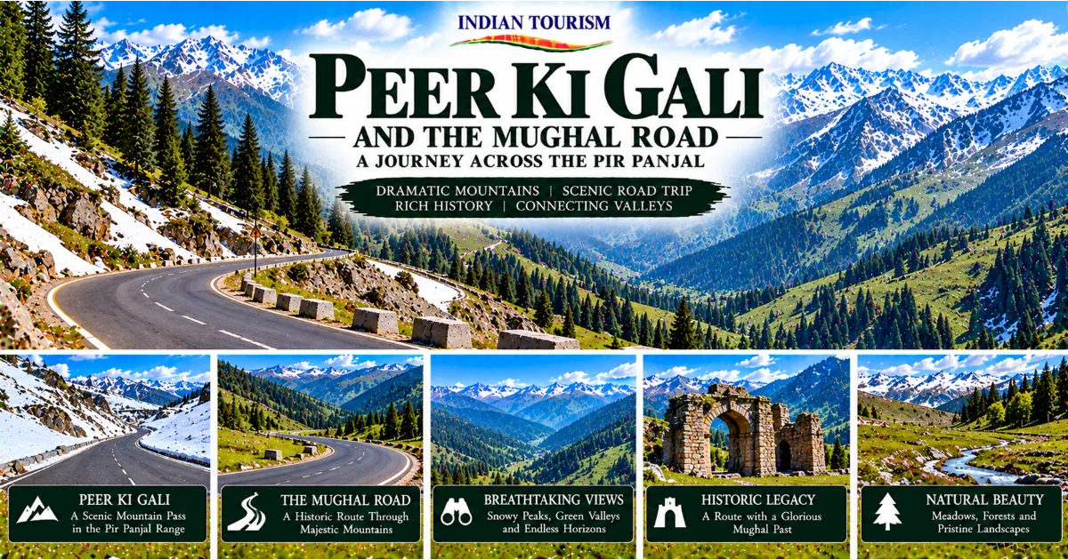
Discovering One of Jammu and Kashmir’s Most Memorable Mountain Journeys
Jammu and Kashmir is known for its celebrated valleys, alpine lakes, snow-covered mountains, historic gardens, and pilgrimage destinations. Yet some of its most rewarding travel experiences lie along the roads that connect these landscapes. Among them, the Mughal Road stands out as a remarkable route through the Pir Panjal mountains, offering a combination of natural beauty, historical significance, and a glimpse into the lives of communities that have inhabited this mountainous region for generations.
At the heart of this journey lies Peer Ki Gali, a high mountain pass associated with the Mughal Road and the dramatic landscapes of the Pir Panjal range. Surrounded by rugged mountains, sweeping slopes, seasonal snow, and vast stretches of open countryside, the pass offers a very different experience from the busy tourist centres of Kashmir. The journey is as important as the destination, with changing scenery and mountain settlements revealing the geographical character of the region.
For travellers who enjoy road trips, photography, mountain landscapes, and historical routes, Peer Ki Gali is an especially interesting destination. It combines the excitement of travelling through a high mountain pass with the opportunity to understand how geography shaped movement between the Kashmir Valley and the southern districts of the region.
The Mughal Road is more than a scenic highway. It recalls an older network of travel and communication that linked Kashmir with the plains and foothills to the south. Emperors, officials, soldiers, traders, travellers, and local communities used mountain routes to cross difficult terrain long before modern roads and vehicles transformed regional travel.
Exploring Peer Ki Gali therefore means experiencing two journeys at once. One unfolds across the spectacular mountain environment of the Pir Panjal range. The other follows the historical connections that made this landscape an important corridor between different parts of the region.
Understanding the Geography of Peer Ki Gali
Peer Ki Gali is a mountain pass in the Pir Panjal range, situated along the Mughal Road between the Kashmir Valley and the Rajouri and Poonch side of the region. It lies in a high-altitude landscape where mountain slopes, open meadows, rocky ridges, and forests create a dramatic setting.
The Pir Panjal range forms an important geographical barrier between the Kashmir Valley and the lower areas to its south. Its mountains influence local weather, snowfall, vegetation, and patterns of movement. Roads crossing this range must negotiate steep gradients, sharp bends, exposed slopes, and rapidly changing weather conditions. Peer Ki Gali represents one of the most notable points along this challenging mountain crossing.
The pass is not simply a point on a map. It is a place where the scale of the surrounding mountains becomes especially apparent. Travellers can see how ridges overlap in the distance, how open slopes transition into forested areas, and how the road follows the contours of the terrain.
The experience changes with the seasons. During warmer months, the surrounding landscape can display green slopes and open mountain scenery. During colder periods, snow and ice may cover sections of the pass and surrounding terrain. The exact conditions vary from year to year, making it important for visitors to obtain current information before travelling.
The high elevation also affects the way visitors experience the environment. Temperatures may be significantly lower than those in nearby towns and the Kashmir Valley. Even when the weather is pleasant at the beginning of a journey, conditions near the pass can be cold, windy, or cloudy.
Understanding these geographical realities helps travellers appreciate Peer Ki Gali beyond its photographs. Its beauty comes from the same mountain environment that makes it a demanding place for road construction and travel.
The Pir Panjal Range: Mountains That Shape the Region
The Pir Panjal range is one of the most significant mountain systems in the northwestern Himalayas. It separates the Kashmir Valley from much of the region to its south and influences the movement of people, water, wildlife, and weather across the landscape.
For centuries, these mountains have shaped settlement patterns and regional connections. Communities developed ways of travelling through valleys and passes, using routes that took advantage of the terrain while avoiding some of its most difficult sections. Seasonal conditions determined when journeys were possible and how long they might take.
The range also supports a rich variety of natural environments. Lower slopes may contain forests and cultivated land, while higher elevations support alpine vegetation, open meadows, and rocky terrain. Snowfall and melting snow contribute to the region's water systems, while the mountains provide habitats for a variety of plant and animal species.
The scenery around Peer Ki Gali reflects this diversity. A single journey may include dense woodland, exposed mountain slopes, broad grassy areas, distant ridgelines, and valleys that disappear behind successive ranges. This variety makes the route attractive to travellers who enjoy observing landscapes rather than simply reaching a destination.
The Pir Panjal mountains are also closely connected to local culture. Pastoral communities have historically used highland meadows for seasonal grazing. Mountain settlements have developed traditions suited to difficult terrain and changing weather. Roads and passes have served as channels of exchange, allowing people, goods, stories, and customs to move between neighbouring areas.
For visitors, the mountains offer more than a visual spectacle. They provide the setting for understanding the relationship between geography and everyday life in Jammu and Kashmir.
The Mughal Road: A Historic Corridor Through the Mountains
The Mughal Road is one of the most historically significant routes connecting the southern districts of Jammu and Kashmir with the Kashmir Valley. Its modern road alignment follows a corridor associated with older routes through the Pir Panjal mountains.
The historical importance of this corridor is closely linked to the Mughal period, when Kashmir became an important destination for imperial travel and administration. Mountain routes provided access between the plains and the valley, although journeys were often difficult and depended on weather, terrain, available supplies, and the condition of the route.
The historic journey to Kashmir was not comparable to a modern road trip. Travellers could face long stretches of uneven ground, steep ascents, cold temperatures, river crossings, and the possibility of delays caused by rain or snowfall. Pack animals, human porters, and organised travelling groups played important roles in moving people and supplies through the mountains.
Routes across the Pir Panjal also supported connections beyond imperial travel. Local inhabitants, merchants, pastoralists, and other travellers used mountain corridors according to their needs and the conditions of the season. These routes linked settlements and helped maintain relationships between communities on opposite sides of the range.
The modern Mughal Road has renewed the practical importance of this corridor by providing road connectivity between the Kashmir Valley and districts such as Poonch and Rajouri. It has also made several landscapes along the route more accessible to visitors.
However, the modern road should not be mistaken for an unchanged surviving highway from the Mughal era. Present-day road infrastructure, engineering works, and alignments belong to a different period of construction. The historical significance lies in the wider corridor and its longstanding role in connecting Kashmir with the areas to the south.
This distinction is important when exploring the route. Its appeal comes from the meeting of historical memory and contemporary travel, rather than the assumption that every section of the present road preserves the exact track used by historical travellers.
Why Peer Ki Gali Is an Important Stop
Peer Ki Gali is a natural highlight of the Mughal Road because it brings the mountain landscape into sharp focus. The road climbs towards the pass, and the surroundings gradually change as the terrain becomes more exposed and the air cooler.
For many visitors, the experience begins well before reaching the highest section. The road winds through changing scenery, passing forested slopes, mountain villages, open stretches, and viewpoints where the scale of the Pir Panjal range becomes increasingly impressive.
The pass itself provides an opportunity to pause and appreciate the landscape. On clear days, the surrounding mountains and ridgelines create a broad panorama. During cloudy weather, mist may move across the slopes, giving the mountains a quieter and more mysterious appearance. In periods of snow, the landscape can look entirely different, although winter conditions may also make travel difficult or impossible.
Peer Ki Gali is also associated with local religious and cultural traditions. The name is linked to a revered figure known as a peer, a term commonly used in the region for a spiritual guide or saint. Local accounts and traditions give the place cultural meaning beyond its geographical role as a mountain pass.
Visitors should approach these traditions respectfully. Religious sites and locally significant places are not merely tourist attractions. They are part of the cultural landscape and may hold personal or spiritual importance for residents and travellers.
The combination of scenery, history, and cultural associations makes Peer Ki Gali a rewarding stop for those who want to understand the Mughal Road as more than a driving route.
A Journey Through Changing Mountain Landscapes
One of the strongest reasons to explore the Mughal Road is the variety of scenery along the way. The journey crosses landscapes that differ in vegetation, elevation, settlement patterns, and atmosphere.
Lower sections may include agricultural fields, villages, forested slopes, and roads that follow valleys and streams. As the route climbs, the surrounding mountains become more prominent. Forests may open into broad slopes, while distant ridges appear and disappear as the road bends around the terrain.
These changes make the journey particularly appealing to photographers and nature enthusiasts. Instead of relying on one viewpoint, travellers can observe the gradual transformation of the environment. The road itself becomes part of the experience, with each turn revealing a different arrangement of mountains, valleys, and vegetation.
The changing landscape also reflects the region's climatic differences. Elevation affects temperature and snowfall, while the direction of slopes and local weather patterns influence the distribution of forests and grasslands. A route through the mountains can therefore reveal how natural conditions change over relatively short distances.
Travellers should resist the temptation to stop wherever a photograph appears attractive. Mountain roads may have blind bends, narrow sections, loose stones, and limited visibility. A safe, designated stopping place is always preferable to pulling a vehicle onto an exposed shoulder.
When conditions permit, a slower journey allows visitors to observe the environment more carefully. The aim should be to enjoy the scenery without obstructing traffic, damaging vegetation, or putting people at risk.
Forests, Meadows and the Natural Environment
The natural surroundings of the Mughal Road form an important part of its appeal. Depending on the section of the route and the season, travellers may encounter forested slopes, grassy clearings, highland meadows, streams, and mountain ridges.
Forests contribute to the stability of mountain ecosystems. Tree cover can help reduce soil erosion, provide habitats for wildlife, and influence local water conditions. In mountainous terrain, vegetation is particularly important because steep slopes are vulnerable to erosion when exposed to heavy rain or disturbed by poorly managed construction.
Higher areas may support seasonal grasslands used by pastoral communities. Such landscapes have long played a role in local livelihoods, especially where livestock grazing depends on the availability of fresh vegetation during warmer months. The movement of animals between lower and higher grazing areas reflects a practical understanding of seasonal changes in the mountains.
The natural environment is not separate from human activity. Roads, settlements, grazing, tourism, and infrastructure all affect the landscape. Responsible travel therefore requires visitors to recognise that scenic places are also living environments with ecological and economic importance.
Travellers should avoid littering, picking wildflowers, disturbing animals, or walking into fragile areas simply to obtain a photograph. Plastic waste is especially harmful when it remains in streams, roadside vegetation, and grazing areas.
A visit to Peer Ki Gali can be an opportunity to appreciate the natural wealth of Jammu and Kashmir while recognising the importance of protecting it. The mountains will remain attractive to future generations only if the pressures created by tourism are managed carefully.
The Cultural Connections Between Kashmir, Poonch and Rajouri
The Mughal Road connects areas with distinct but interconnected regional identities. The Kashmir Valley, Poonch, and Rajouri have their own histories, languages, food traditions, settlement patterns, and cultural practices. Mountain routes have helped maintain contact between these areas over long periods.
Geographical barriers can make communities appear isolated when viewed on a map. Historically, however, people found ways to cross these barriers through trade, pastoral movement, pilgrimage, administration, and family connections. Passes and valleys were essential parts of these relationships.
The communities living along the Mughal Road have developed livelihoods adapted to mountain conditions. Agriculture, livestock rearing, small businesses, transport services, and other forms of local work contribute to the regional economy. In some areas, seasonal changes influence both daily routines and the movement of people.
Travellers can gain a richer understanding of the region by paying attention to these local realities. A village is not simply a point to pass through on the way to a viewpoint. It is a place where people live, work, educate their children, maintain traditions, and manage the practical challenges of mountain life.
Visitors should also remember that cultural diversity cannot be reduced to a single description of Jammu and Kashmir. The region contains many communities, and their experiences differ according to location, history, language, and livelihood.
Respectful interactions, responsible purchases, and consideration for local customs help make tourism more beneficial. Buying refreshments or locally made products from legitimate local businesses can support livelihoods, while asking permission before photographing people respects their privacy.
The Mughal Road is therefore valuable not only for its scenery but also for the opportunity it offers to understand the connections between neighbouring parts of the region.
Best Time to Visit Peer Ki Gali
The best time to visit Peer Ki Gali depends on road conditions, weather, the type of scenery a traveller hopes to experience, and whether the route is officially open.
Late Spring and Early Summer
Late spring and early summer can offer a pleasant combination of fresh vegetation, changing mountain colours, and relatively comfortable conditions in the lower areas. Higher sections may remain cold, and snow can persist in some locations depending on the winter and the year's weather.
This period can be attractive for travellers who enjoy green landscapes and mountain views. However, visitors should not assume that the pass will be accessible simply because conditions are warm in Jammu or Srinagar. The weather at high elevation can be very different.
Summer
Summer is often a popular period for mountain travel because temperatures in the higher areas can be more comfortable than in the plains. The route may offer open views, green slopes, and opportunities to observe the landscape without the more severe conditions associated with winter.
Summer travel can still be affected by rain, landslides, road repairs, traffic, and temporary restrictions. A clear morning does not guarantee that conditions will remain favourable throughout the day.
Early Autumn
Early autumn can provide a quieter atmosphere and changing colours in parts of the surrounding landscape. Temperatures may become colder, especially during the morning and evening, and daylight hours gradually shorten.
Travellers visiting during this period should plan to complete the mountain crossing with sufficient daylight remaining. A flexible itinerary is useful because weather and road conditions can change.
Winter
Winter can bring heavy snowfall and difficult travel conditions to high sections of the Pir Panjal range. The road may be closed or restricted during periods of severe weather, and ice can create dangerous driving conditions.
Winter should not be treated as a guaranteed opportunity to see snow at Peer Ki Gali. Even when snow is present, access may be unsafe or unavailable. Anyone considering winter travel should verify the latest official road status and follow local instructions.
In every season, the most important consideration is current accessibility. The Mughal Road is a mountain route, and travel decisions should be based on verified information rather than photographs or reports from a different date.
How to Reach Peer Ki Gali
Peer Ki Gali can be reached by road along the Mughal Road, which connects the Kashmir side with the Poonch and Rajouri side. The best approach depends on the starting point, the condition of the road, the time available, and any restrictions in effect.
Travellers starting from Srinagar may travel towards the southern Kashmir area and join the relevant approach to the Mughal Road. Those starting from Poonch or Rajouri can travel from the southern side, subject to current road conditions and access arrangements.
Exact journey times vary considerably. Distance alone is not a reliable way to estimate travel time in mountainous terrain. Narrow sections, sharp bends, traffic, roadwork, weather, and the condition of the vehicle can all affect progress.
A private vehicle offers flexibility for stopping at suitable viewpoints, but drivers should be comfortable with mountain roads. A vehicle with sound brakes, properly maintained tyres, functional lights, and sufficient fuel is essential. Drivers unfamiliar with the route may prefer an experienced local driver who understands the road and its changing conditions.
Before departure, check official traffic or road-status updates, weather forecasts, and any relevant local advisories. Ask about restrictions that may affect the route, including temporary closures, maintenance, or security-related measures. Do not depend exclusively on an online map to determine whether a mountain road is currently passable.
Travellers should also carry drinking water, snacks, warm clothing, a charged mobile phone, and essential personal items. Mobile connectivity may be unreliable in some mountain sections, so important information should be saved or obtained before entering areas with weak signals.
If the route is closed, do not attempt to bypass barriers or follow unofficial tracks. A revised itinerary is always preferable to taking unnecessary risks.
A Suggested Road Trip Experience
A visit to Peer Ki Gali can be planned as a day journey or included in a longer trip through the southern districts and the Kashmir Valley. The most suitable itinerary depends on the starting point and the amount of time available.
For a day trip from the Kashmir side, travellers can begin early, allowing time for the drive, safe stops, and changing weather. The journey should be planned around official road information rather than a fixed promise that the pass will remain accessible all day.
Visitors can pause at appropriate viewpoints, observe the surrounding forests and mountains, and learn about the historical role of the Mughal Road. The objective should be to enjoy the journey at a comfortable pace instead of trying to cover too many stops.
Those travelling from Poonch or Rajouri may prefer to combine the mountain crossing with time spent exploring local settlements and cultural attractions. Depending on the route and available time, an overnight stay in an appropriate town may make the journey more relaxed.
A longer itinerary can include destinations elsewhere in the region, but distances and road conditions must be considered carefully. It is unwise to assume that a mountain crossing will always take the same amount of time or that every planned stop will be accessible.
Travellers should also leave enough time for the return journey. Reaching the pass late in the day may create difficulties if weather deteriorates or traffic slows down. A good mountain itinerary includes flexibility, adequate rest, and a clear plan for returning safely.
Photography Tips for Peer Ki Gali
Peer Ki Gali is well suited to landscape photography because of its open mountain views, winding road, changing light, and seasonal contrasts. Even travellers using a mobile phone can capture memorable images by paying attention to composition and weather.
Early morning and late afternoon may provide softer light, although the best time depends on cloud cover and the direction of the view. Overcast conditions can create a subtle atmosphere, while clear skies may reveal more distant ridgelines.
Wide landscape photographs can communicate the scale of the mountains, while closer compositions can focus on textures such as rocks, grasses, forest edges, and the curves of the road. Including a road or a small section of vegetation in the foreground can help convey depth.
Weather can change rapidly, so visitors should protect their equipment from moisture, dust, and cold. Batteries may also lose charge more quickly in low temperatures. Keeping spare power available is sensible, particularly when the journey is long.
Safety must come before photography. Do not stand in traffic lanes, climb unstable slopes, or stop at blind bends. Drone use may be subject to legal, security, environmental, or local restrictions, so travellers should not fly a drone without confirming that it is permitted.
The strongest photographs often come from patience and observation. A short pause at a safe viewpoint can be more rewarding than rushing from one location to another.
Responsible Tourism Along the Mughal Road
Responsible tourism is especially important in mountain environments because natural systems can be sensitive to disturbance. The road makes it easier for visitors to reach areas that were once more difficult to access, but increased movement also creates responsibilities.
The first responsibility is to manage waste properly. Carry reusable water bottles where practical, keep wrappers and packaging in a bag, and dispose of waste at appropriate facilities. Do not throw rubbish into roadside vegetation, streams, or grazing land.
The second responsibility is to respect local communities. Keep noise levels reasonable, avoid blocking access to homes or businesses, and ask permission before photographing people or private property. Religious sites and culturally significant places should be approached with consideration for local customs.
The third responsibility is to protect the natural environment. Stay on established paths where walking is appropriate, avoid damaging plants, and do not disturb wildlife. Vehicles should remain on designated roads rather than driving across grasslands or fragile slopes.
Visitors can also support local livelihoods by purchasing goods and services from legitimate local businesses. Responsible spending can help ensure that tourism provides benefits beyond transport operators and large commercial establishments.
Finally, travellers should understand the limits of their own plans. If authorities restrict access or weather makes travel unsafe, changing the itinerary is part of responsible tourism. No photograph or destination is worth ignoring a road closure or putting local residents and emergency responders at risk.
Safety Advice for the Mountain Crossing
The Mughal Road requires careful preparation. Its mountain terrain, elevation, sharp bends, and variable weather make it different from a straightforward highway journey.
Check the road status shortly before departure and again if possible during the journey. Weather conditions can change quickly, and information that was accurate the previous day may no longer be reliable. Follow official instructions and do not enter a closed section.
Drive at a controlled speed and maintain a safe distance from other vehicles. Use suitable gears on steep gradients and avoid sudden braking where possible. Drivers should not overtake near blind bends or where visibility is limited.
Be prepared for lower temperatures near the pass. Warm layers, rain protection, suitable footwear, drinking water, and basic supplies can make an unexpected delay easier to manage. Travellers should also consider their own comfort and tolerance for high-altitude conditions.
Avoid travelling late in the day if it would leave insufficient time for the return journey. Darkness reduces visibility and makes it harder to identify road damage, animals, and other hazards.
If conditions deteriorate, follow local advice and stop only in safe, permitted locations. Do not continue simply because a destination is close. Mountain weather and road conditions can make the final stretch more difficult than expected.
Where to Stay During a Mughal Road Trip
Accommodation choices depend on the starting point, the direction of travel, the length of the itinerary, and the facilities available along the route. Larger towns on either side of the mountain crossing may provide a more dependable range of lodging, food, fuel, and other services than isolated sections of the road.
Travellers should research accommodation before departure, especially during busy travel periods. Confirm whether the property is operating, how far it is from the intended route, and whether late arrival is possible.
Do not assume that a remote viewpoint has nearby hotels, restaurants, public toilets, or reliable mobile coverage. Facilities can be limited in mountain areas, and services may be seasonal.
For a day trip, staying in a larger town and returning before dark may be the simplest option. For a longer journey, an overnight stop can reduce driving pressure and create more time for exploring local attractions.
Where possible, choose accommodation that follows responsible waste and water practices. Visitors should also respect the needs of local residents, particularly in smaller settlements where tourism facilities may share limited resources.
Food and Local Experiences Along the Route
A road journey through Jammu and Kashmir can provide opportunities to experience regional food traditions, although the availability of particular dishes depends on the towns and villages visited.
Travellers may find local tea, breads, rice dishes, and regional meals in established eateries along the wider route. The food available in a particular location may differ from what is offered in Srinagar, Jammu, Poonch, or Rajouri because each area has its own culinary influences.
Eating at a clean, established local business can support the people who live and work in the region. Visitors should ask about ingredients when they have dietary requirements and carry simple snacks for sections where shops may be sparse.
The wider experience also includes observing village life, agricultural landscapes, local markets, and the ways people adapt to mountain conditions. These encounters can make the journey more meaningful than a quick stop for photographs.
Travellers should avoid treating rural communities as staged attractions. Respectful curiosity, appropriate conversation, and consideration for people's privacy help create better interactions for everyone.
Who Should Visit Peer Ki Gali?
Peer Ki Gali is especially suitable for travellers who enjoy mountain scenery, road journeys, geography, and regional history. It can appeal to photographers, nature enthusiasts, families with an interest in landscapes, and visitors who want to explore a less conventional route through Jammu and Kashmir.
Road-trip enthusiasts may appreciate the winding mountain drive and the changing scenery. History enthusiasts can use the journey as an opportunity to understand the importance of older routes connecting Kashmir with the south. Nature lovers may enjoy observing forests, meadows, and the wider mountain environment.
However, the route may not suit every traveller at every time of year. Those who are uncomfortable with winding roads, high elevations, or unpredictable weather should consider their needs before planning the crossing. Families travelling with young children should prepare for cold conditions, possible delays, and limited facilities in some sections.
Visitors with mobility requirements should investigate the accessibility of stops and facilities before travelling. The terrain around a high mountain pass may be uneven, and convenient access to every viewpoint cannot be assumed.
The key is to plan according to the conditions and the needs of the people travelling. Peer Ki Gali is best enjoyed when the journey is approached with patience, realistic expectations, and respect for the mountain environment.
Why the Mughal Road Deserves a Place in Your Jammu and Kashmir Itinerary
Many journeys through Jammu and Kashmir focus on well-known destinations in the Kashmir Valley or the established tourist centres of the Jammu region. The Mughal Road offers another perspective by connecting mountain landscapes with the history and everyday life of communities across the Pir Panjal range.
Peer Ki Gali is a particularly memorable part of this experience. The pass brings travellers into a high mountain environment where open slopes, distant ridges, and changing weather reveal the character of the range. Its cultural associations and position along a historically important corridor add depth to the visit.
The route also demonstrates how geography has shaped regional history. Mountains can create barriers, but passes and valleys provide ways through them. Over time, these routes have supported travel, trade, administration, pastoral movement, and cultural exchange. Modern roads continue this tradition of connection, even as their construction and use differ from those of earlier centuries.
A visit should not be measured only by the number of places covered or the photographs collected. The most rewarding experience may come from understanding the relationship between the landscape, the route, and the people who live nearby.
Travellers who plan carefully, follow road restrictions, respect local customs, and protect the environment can experience the Mughal Road as more than a scenic drive. It becomes a journey through the geographical and cultural connections that make Jammu and Kashmir such a distinctive region.
Final Thoughts
Peer Ki Gali and the Mughal Road offer an engaging combination of mountain scenery, regional history, and cultural connections. The journey through the Pir Panjal range reveals how roads and passes have linked communities on either side of the mountains, while the landscape provides a powerful reminder of the natural forces that shape life in the Himalayas.
Peer Ki Gali is a destination for travellers who appreciate the experience of the journey itself. Its high mountain setting, changing weather, open slopes, and historical associations make it a valuable addition to a thoughtfully planned itinerary through Jammu and Kashmir.
Before travelling, check current road conditions, follow official advice, and allow sufficient time for the mountain crossing. Respect local communities, avoid littering, and remember that the region's natural and cultural heritage deserves careful protection.
With sensible preparation and a flexible plan, the Mughal Road can become one of the most memorable parts of a trip through Jammu and Kashmir, connecting the beauty of the Pir Panjal mountains with the stories of the people and routes that have crossed them for generations.
#IndianTourism #PeerKiGali #MughalRoad #JammuAndKashmir #PirPanjal #KashmirTravel #Poonch #Rajouri #MountainRoadTrip #HimalayanTravel #ExploreIndia #ResponsibleTourism